
From majestic waterfalls and glacial lakes to steaming hot springs and wild lava fields, the Diamond Circle offers something for everyone.
In this article, we’ll show you how to explore Iceland’s Diamond Circle with tips on what to see and do and when the best time to visit is. So get ready for adventure as we uncover the secrets of this majestic part of Iceland!
What is the Diamond Circle?
The Diamond Circle in Iceland is a gorgeous drive with stunning scenery and interesting history and culture. It has sometimes been referred to as North Iceland’s answer to the Golden Circle sightseeing route. However, the Diamond Circle is much larger than its southern counterpart, and it takes you through key places, which include:
- Goðafoss Waterfall
- Húsavík Village
- Ásbyrgi Canyon
- Dettifoss Waterfall
- Lake Mývatn Region including:
- Námaskarð Geothermal Area
- Dimmuborgir Lava Fields
- Grjótagjá Cave
This 250 km (155 m) detour off the Ring Road (or Route 1) offers stunning views and countless activities. So whether you’re into adventure, hiking, sightseeing, or just taking it easy and soaking up the scenery—the Diamond Circle has something for everyone.
Why You Should Visit the Diamond Circle
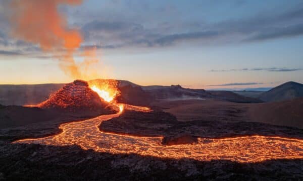
Visiting the Diamond Circle is a must for anyone looking to experience everything Iceland has to offer. The route takes you through some of the world’s most beautiful and unique landscapes, with something for everyone to enjoy. From majestic canyons and steaming hot springs to awe-inspiring waterfalls and lava fields, it’s a journey that will leave you feeling humbled by nature’s power.
Plus, there are plenty of activities, such as hiking, whale watching, and dog sledding, along the way. So if you’re ready for an adventure like no other, then make sure to add the Diamond Circle to your travel itinerary!
Road Trip: What to See and Do on the Diamond Circle
Starting in the West, this Diamond Circle itinerary travels clockwise through the main stops. After briefly describing each highlighted attraction, I’ve suggested what to do in the surrounding area. Many of these suggestions will be on the way to the following main attraction.
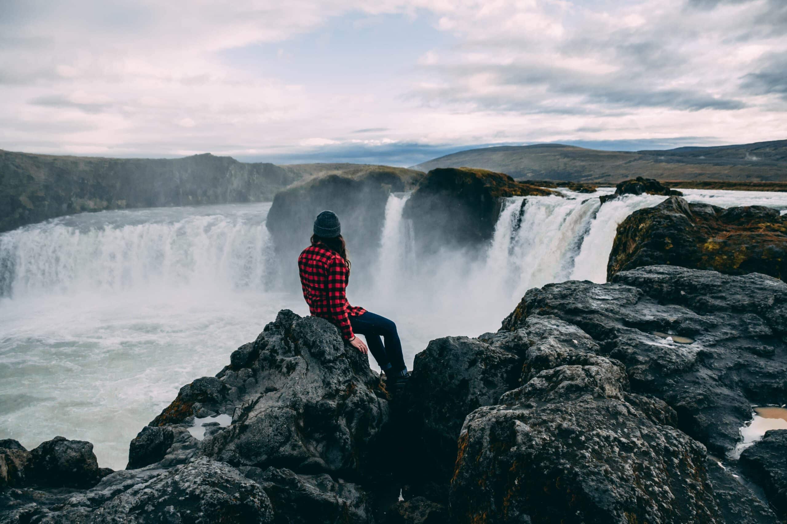
Godafoss Waterfall
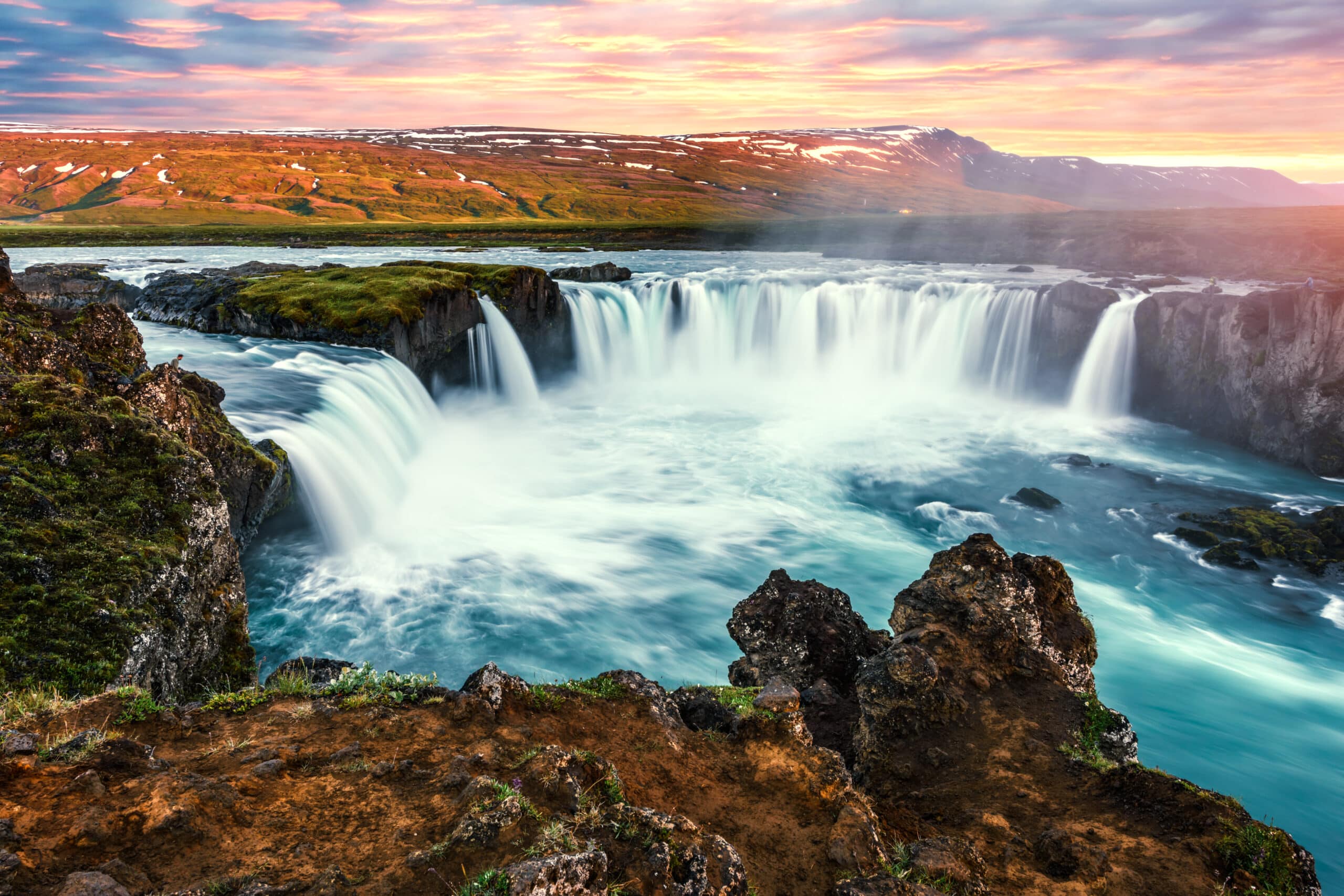
My first experience of Goðafoss Waterfall completely swept me off my feet — and I’m saying this as a person who would typically choose a mountain over a waterfall. As you drive along the road, you begin to notice something in the air up ahead – is it smoke? Fog? No, it’s mist, spraying up from somewhere you can’t quite see yet. And then you can!
Goðafoss is a stunning masterpiece of nature, which is one of the reasons it is a protected waterfall. It actually consists of two main waterfalls and several smaller ones, with up to a 12-metre (39 ft) drop where it is highest. The fall is surrounded by trails on both sides, connected by a small walking bridge, giving you full access to all angles of this beauty.
No Icelandic natural wonder is complete without a piece of folklore. This fall has a special role to play in the religious history of Iceland. According to legend, after Iceland’s conversion to Christianity, the law speaker who had made this decision threw his old pagan effigies into the fall, thus cementing his decision and giving the cascade its name, Waterfall of Gods.
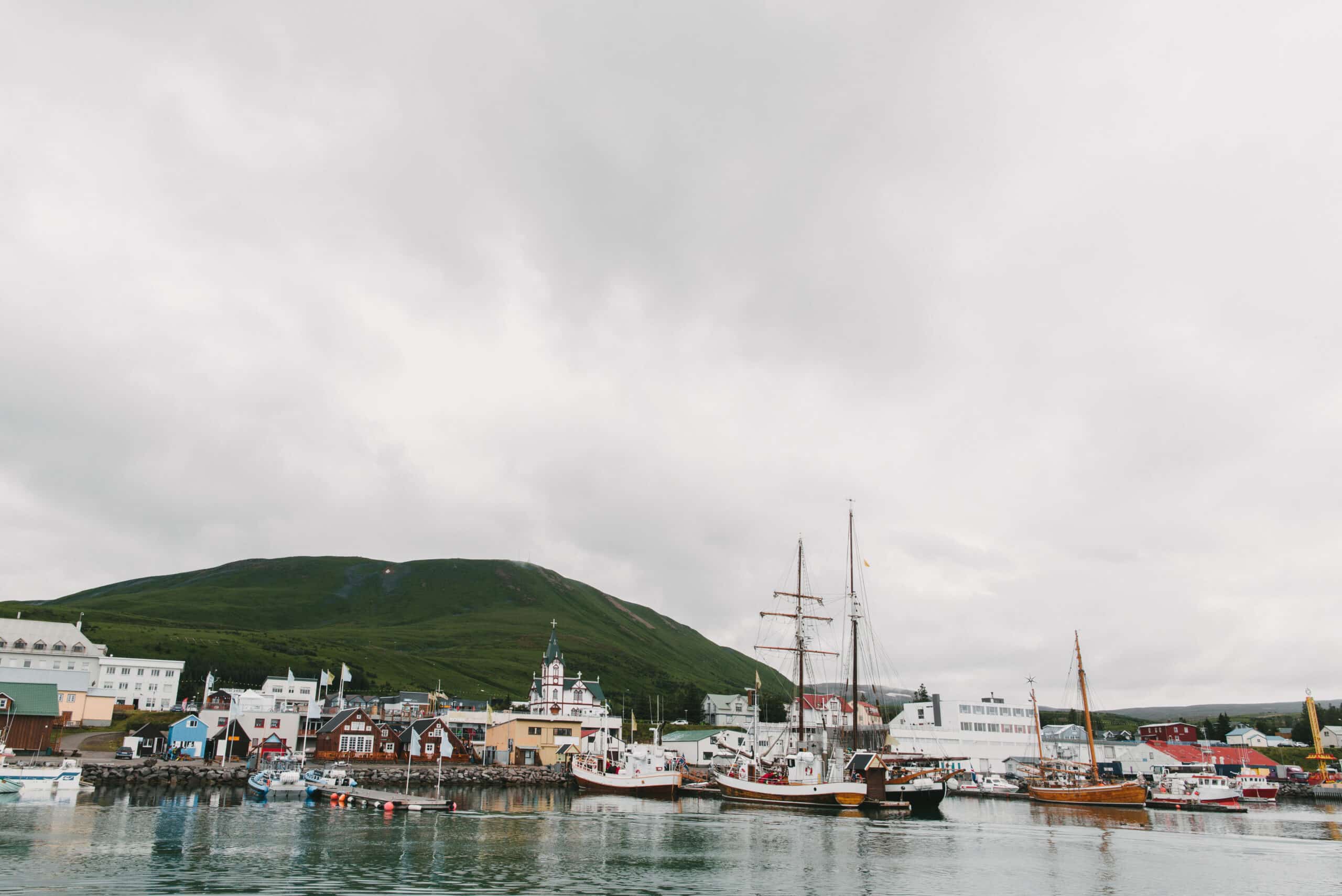
Fishing Village of Húsavík

From Goðafoss, we travel to a cute little town by the bay of Skjálfandi called Húsavík.
It is the first recorded settlement in Iceland, established in 860 by a Swedish Viking who left behind crew members and enslaved people. If there’s one thing about the Icelanders, they are very literal with their names, including town names. And this place is no different: Húsavík translates to Bay of Houses.
Húsavík is known as the ‘Whale Watching Capital of Iceland’. In recent years, whale-watching companies have taken it one step further than just showcasing extraordinary marine life. Here, you’ll find whale watching that provides valuable scientific research as well as efforts to protect and preserve sea life.
Húsavík is the home of culture on the Diamond Circle Route. The town boasts several museums dedicated to whales, human exploration, and culture. In recent years, the village has gained international recognition as it is here that the 2020 Will Ferrell movie Eurovision Song Contest: The Story of Fire Saga takes place. Try and see if you can spot the landmarks that feature in the film!
Off the Beaten Path in and around Húsavík:
- You’ll find several hiking and mountain biking routes, a skiing area, and sea kayaking from the town.
- For a Eurovision-themed stay, visit the Eurovision exhibition featuring facts and artefacts from the Netflix film, as well as highlights from the history of Iceland in the Eurovision Song Contest. Do plan ahead as the exhibition has very limited opening hours. You can also find the Eurovision-themed walking tour or visit Ja Ja Ding Dong bar, located in a hostel on the outskirts of town.
Ásbyrgi Canyon
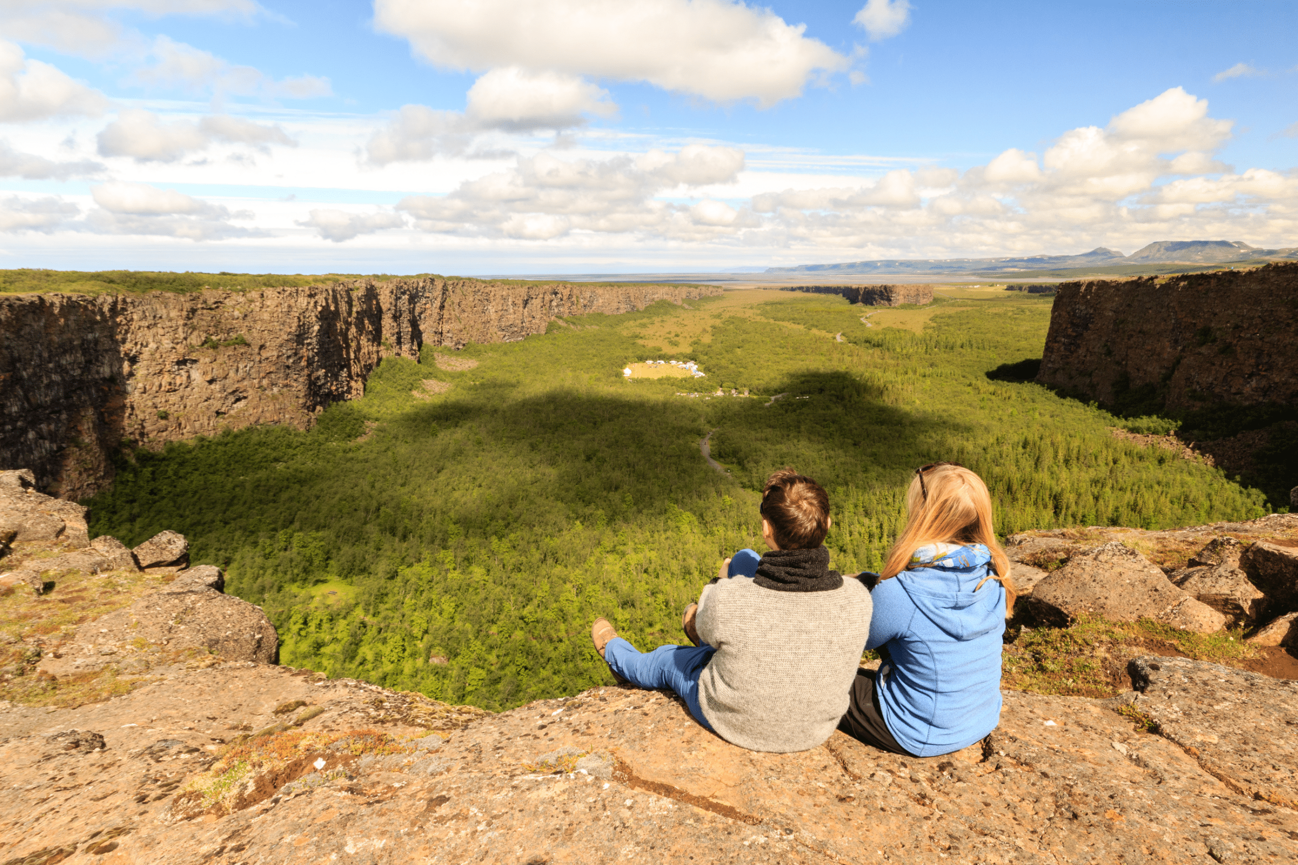
Travelling South on Route 85, you’ll reach Ásbyrgi Canyon, a stunning piece of nature. Part of the Vatnajökull National Park, Ásbyrgi consists of 100-metre-high horseshoe-shaped cliffs created in several volcanic eruptions, the latest one 2,300 years ago. In the pit of the horseshoe, you’ll find a little lake, Botnstjörn, which seems almost like a secret; you wouldn’t know it was there as you drive up to the site. To reach the lake, you must walk across a forested area amongst the volcanic landscape.
Volcanoes are pretty cool, but if you want a cooler explanation for the origin of the unique shape of Ásbyrgi, how about this one: Icelandic folklore has it that Odin’s 8-legged horse, Sleipnir, got too close to the Earth’s surface one day. As a result, one of its feet touched the ground, leaving this massive imprint in its wake.
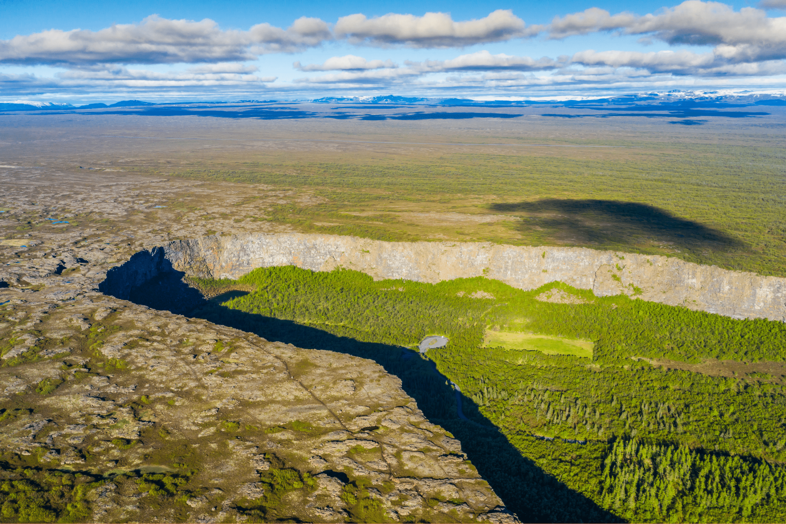
You have nine different walks or hikes to choose from when you’re there. These range from the short 1 km walk from the visitor centre to Botnstjörn, slightly longer 3-4 km traipses, to a 17 km circle through the landscape surrounding the canyon.
Off the Beaten Path around Ásbyrgi Canyon:
- Hljóðaklettar in Jökulsárgljúfur Canyon (no one’s expecting you to be able to pronounce either of these names), also known as the Echo Caves or Whispering Cliffs. Home to caves and unique rock formations, including the so-called Lava Church.
- From there, you can walk to Rauðhólar, a red-tinged chain of volcanic mountains. Tip: when looking for this place online, search for Rauðhólar Vesturdalur to avoid ending up by the other Rauðhólar, just outside of Reykjavík.
Both Hljóðaklettar and Rauðhólar can be accessed by driving towards Dettifoss from the West.
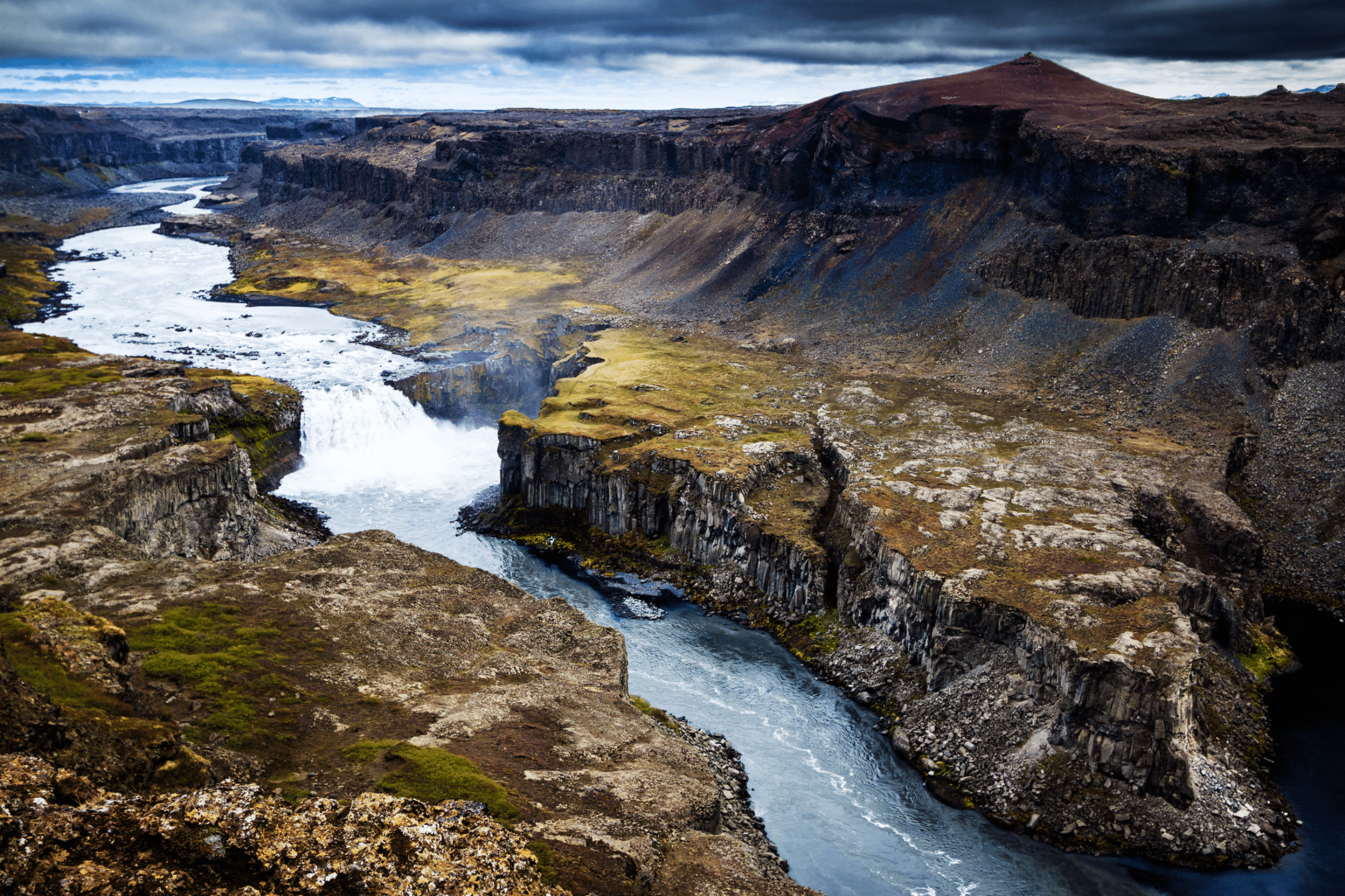
Dettifoss Waterfall
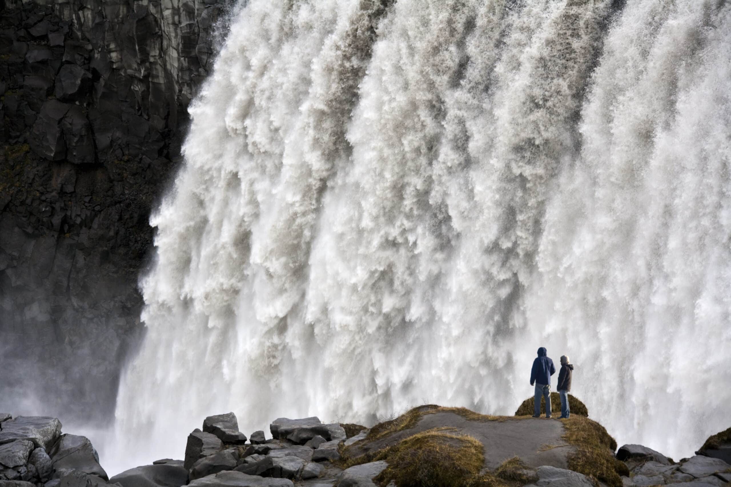
Sci-Fi fans might recognise Dettifoss from the opening scene of Ridley Scott’s 2012 sci-fi movie Prometheus. Located in Vatnajökull National Park, this impressive waterfall is a must-see attraction for any traveller in the region.
The 100 metres (330 ft) wide Dettifoss is known for its incredible power, with hundreds of thousands of gallons of water cascading down from a height of 44 metres (144 feet) every second. Although, sources disagree on whether this is the most powerful waterfall in Europe or “just” the second most powerful.
You can access Dettifoss from the East and West in the summer. However, the eastern road is closed between October and April for safety reasons. Likewise, the route from the West can be temporarily closed in the same period. So make sure you visit safetravel.is to check the road conditions and closures if you’re travelling in the winter months.
Off the Beaten Path around Dettifoss Waterfall:
- For Selfoss (not to be confused with the town in southern Iceland), follow the signs at Dettifoss and walk roughly a kilometre to see this beautiful waterfall.
- Hafragilsfoss Waterfall is a 5-minute drive from Dettifoss, easily found by following the signs.
Both waterfalls are accessible from the East and West roads leading to Dettifoss.
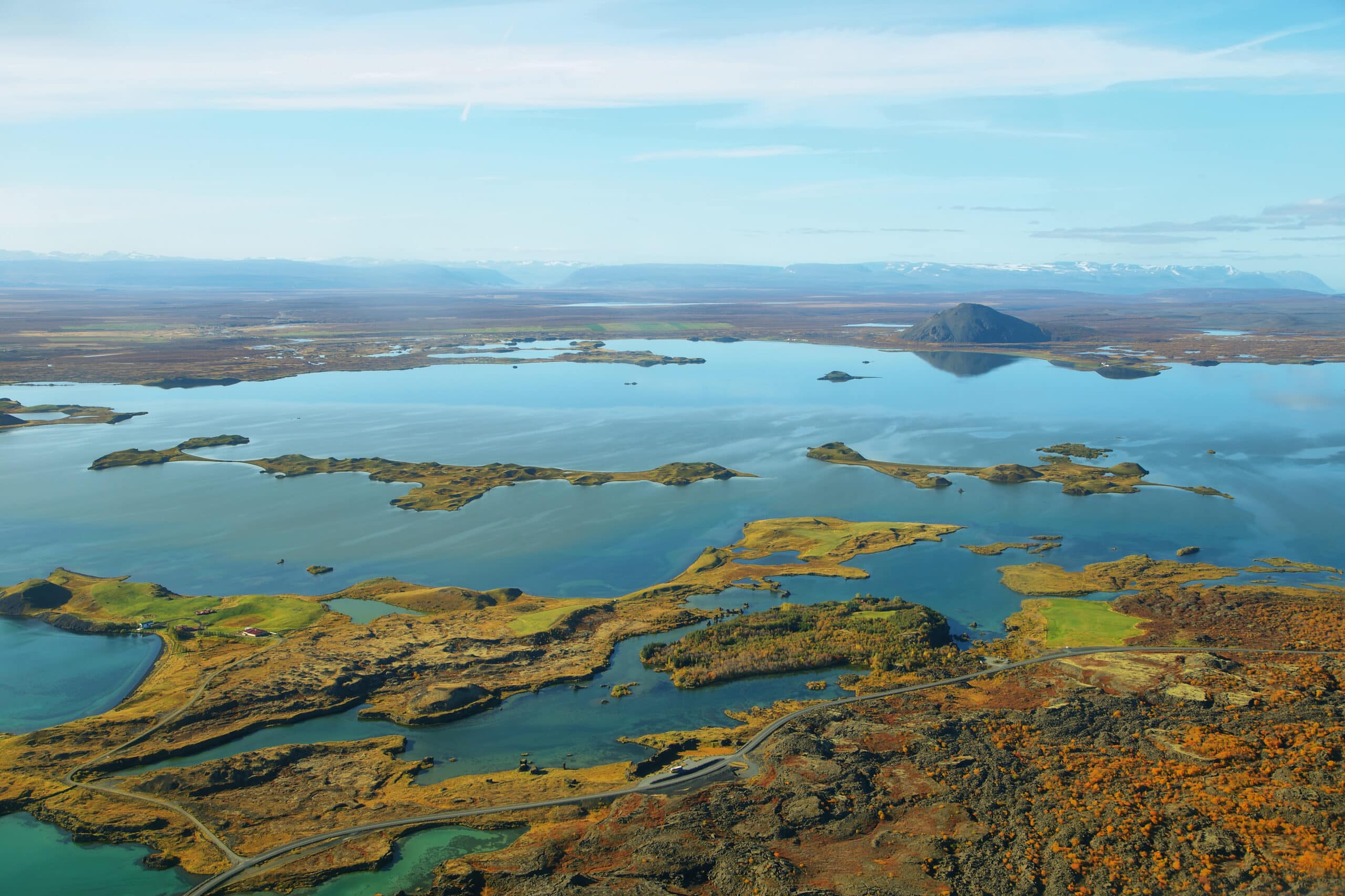
Lake Mývatn Region
Mývatn is a lake, but it’s not just a lake. I mean, it is a lake – the fourth largest in Iceland, in fact. But when people talk about Mývatn, they are talking about the body of water and the surrounding region, found on Road 848, which includes geothermal areas, lava fields, and hot springs.
Lake Mývatn
Lake Mývatn itself takes its name from the midges, a type of mosquito that thrives in the area. Dotted on the lake are about 50 small islands. The water is shallow, allowing for some stunning colours. The lake and its immediately surrounding wetland area are home to a diverse array of plant and animal life, including up to 15 breeds of ducks at certain times of the year.
The lake is home to a unique type of algae that forms into balls. The English name for this algae is Marimo, but the Icelanders call it Kúluskítur, literally meaning balls of shit. While the algae exist in other shapes in other places, this particular version is only found in a few places in the world: famously here in Mývatn and the Akan Lake in Japan.
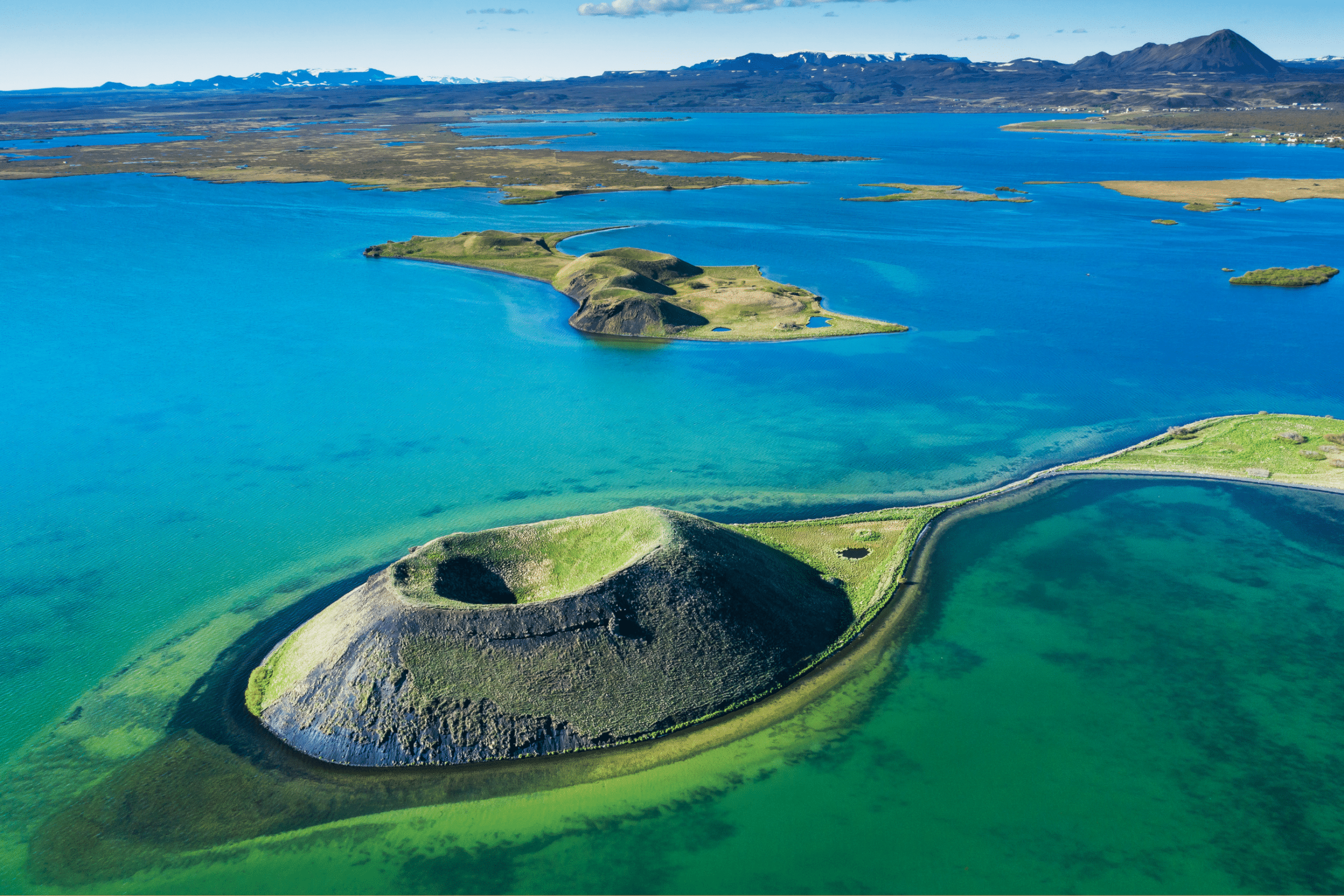
On the North-side of the lake are Skútustaðagígar, several pseudo craters that were created when boiling lava flowed over the wetlands over 2,000 years ago.
Dimmuborgir Lava Field

Dimmuborgir is a large lava field located near Lake Mývatn. It is comprised of various massive and bizarrely-shaped lava pillars, rock formations and caves. Dimmuborgir literally means “dark castles” or “dark cities”, and these captivating mounds feature in many local legends and folk stories.
One such story is of the Icelandic Yule Lads. Dimmuborgir is said to be their home, and if you visit the area in December, you might even catch the Lads entertaining kids or having their annual bath.
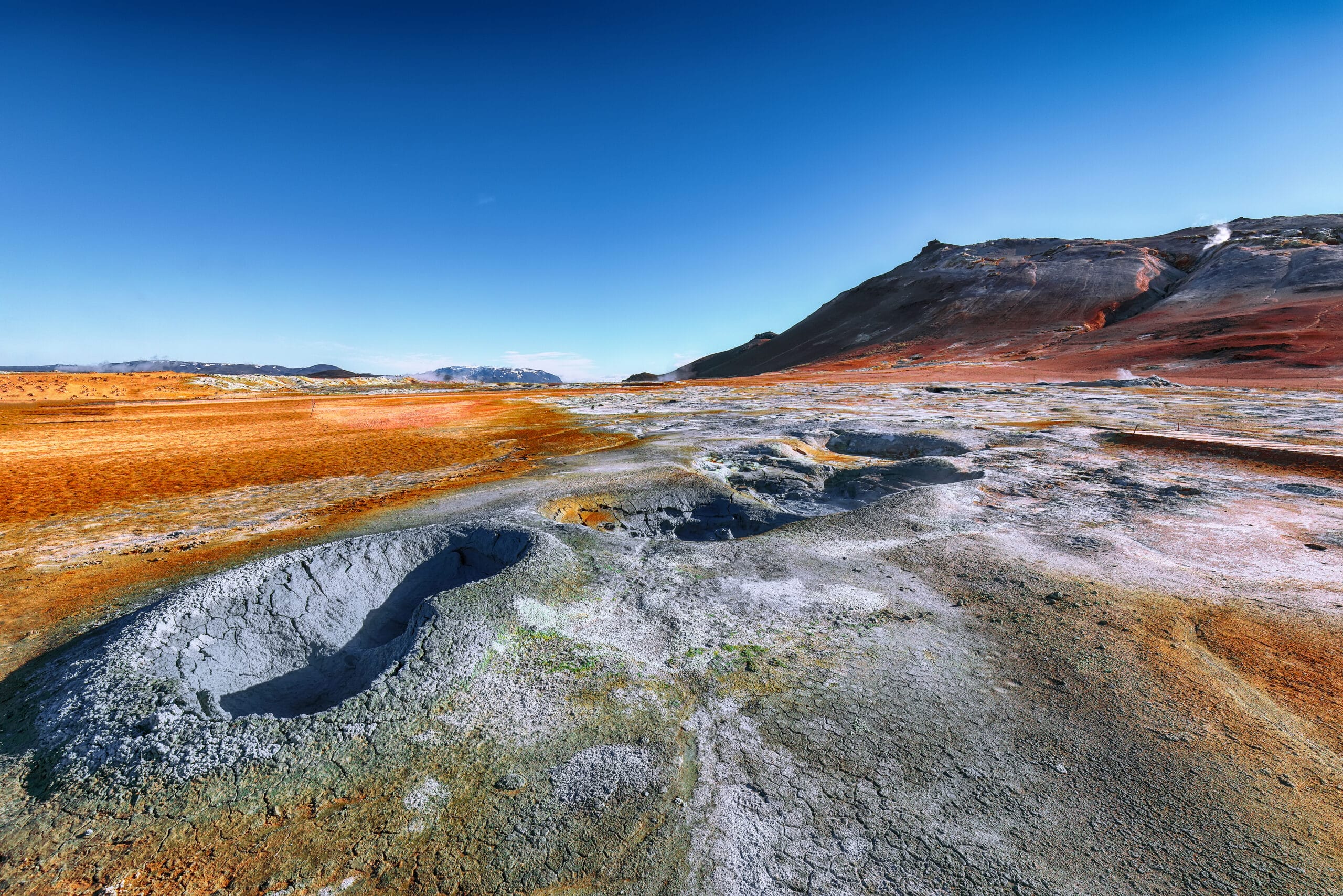
Námaskarð Geothermal Region
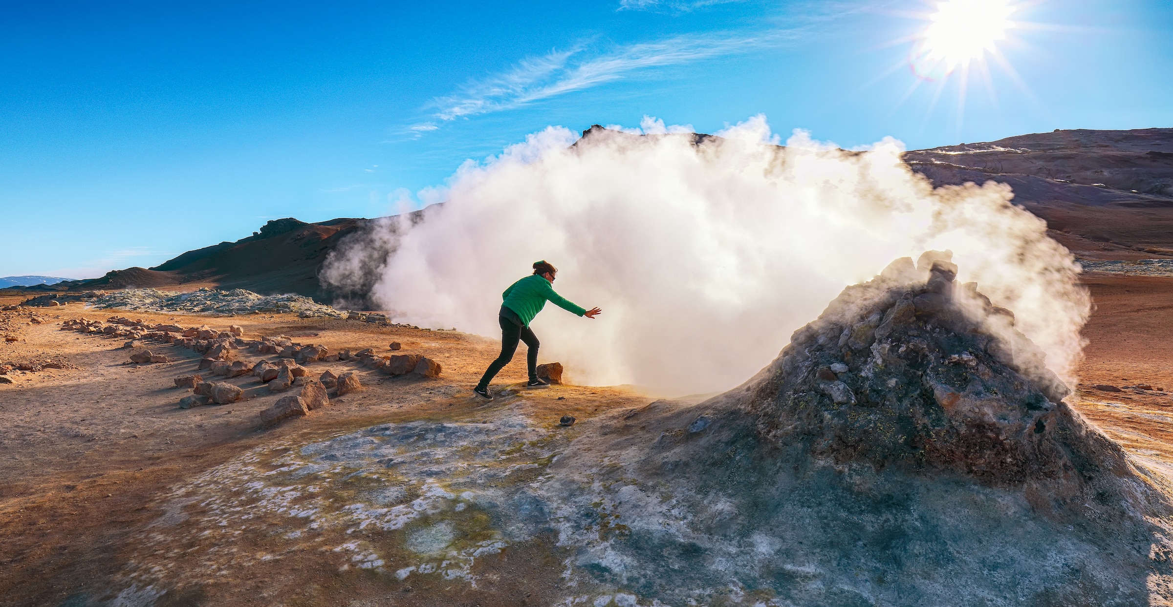
Námaskarð (also known as Hverir) is a region with high geothermal activity and, therefore, a sensory experience.
Here you can feel the warmth of the mud pools and steam vents, take in the landscape’s spectacular, naturally occurring colours and shapes, and smell some *ahem* interesting smells.
Grjótagjá Cave
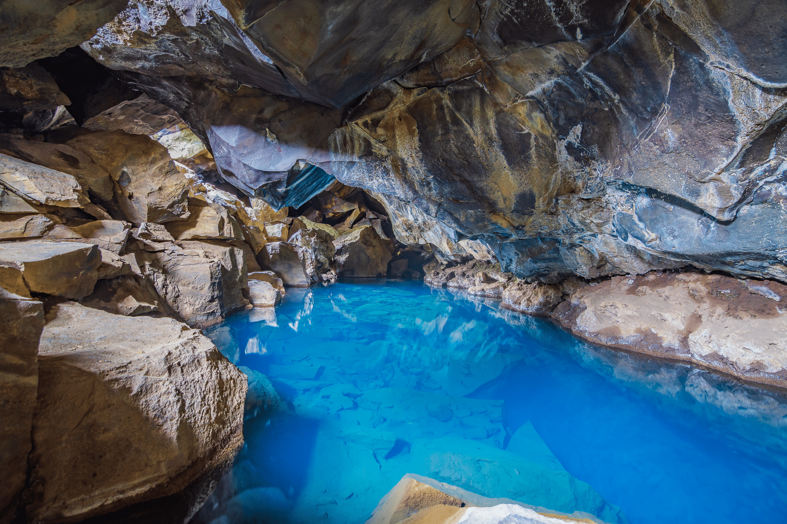
Grjótagjá Cave is a small lava cave containing a hot spring. It is a must-see for fans of the HBO series, Game of Thrones. Here, Jon Snow and Ygritte had a romantic tryst in season 3’s “Kissed by Fire.”
Off the Beaten Path around Lake Mývatn
- Visit Grenjaðarstaður, an old turf house which now functions as a museum. The museum is only open between 15th June and 15th August. However, if you’d only like to see the houses from outside, you can go any time of year.
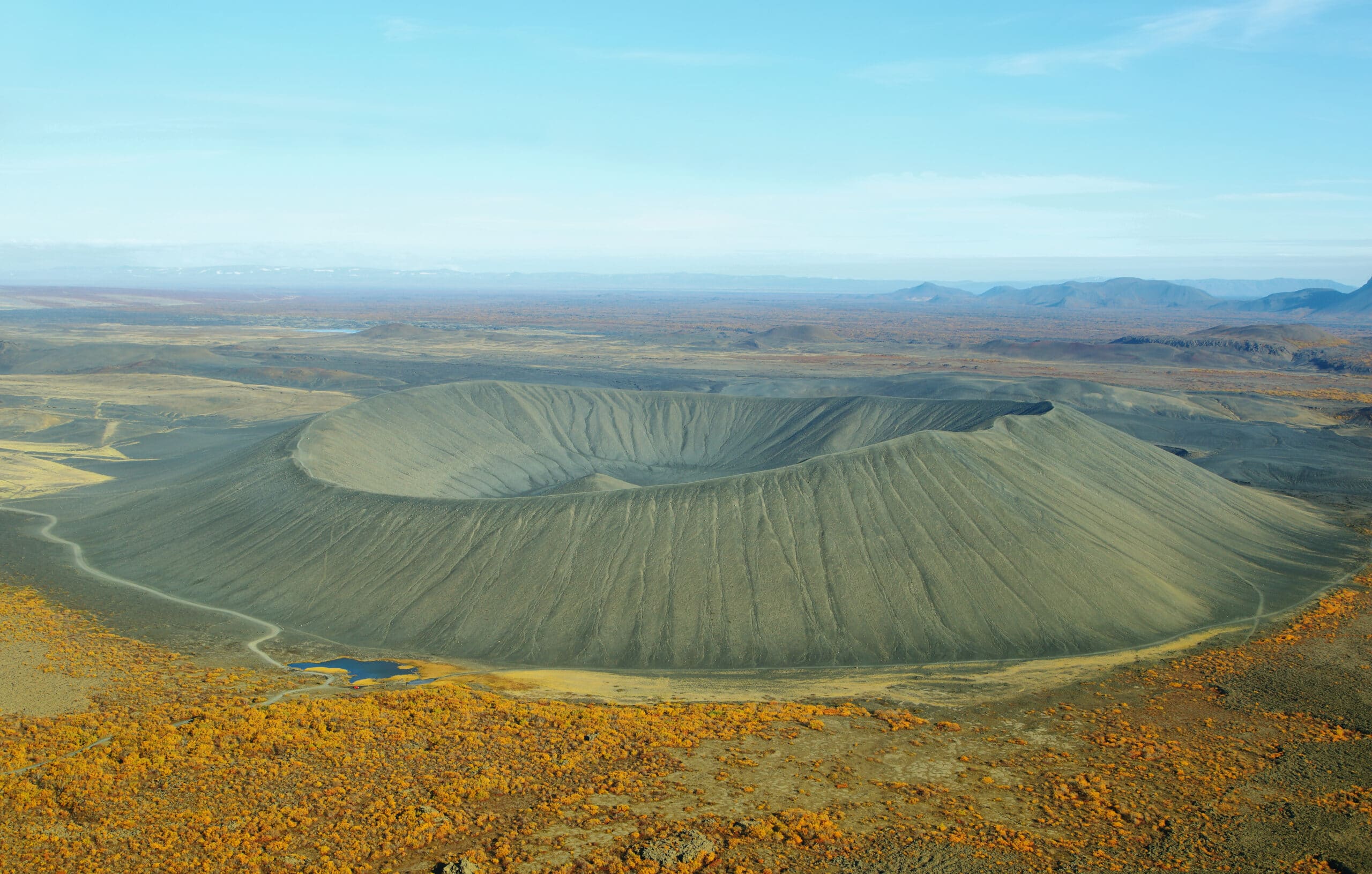
- Mt. Hverfell is a stunningly dark and round tephra cone volcano. Its captivating crater is an impressive 1 km wide and about 140 m deep – almost symmetrical enough to look like a stadium or arena!
Best Tours on the Diamond Circle
So you are travelling around the Diamond Circle and want to spice up your sightseeing with an adventure. But what activities are available? Well, I’m happy to help!
Whale Watching in Húsavík

Whale Watching in Húsavík is one of the most popular activities in Iceland. The waters around this charming town offer some of the best whale-watching excursions as it is home to several species of whale and various other wildlife.
Aside from a traditional whale-watching tour on a wooden boat, there is also a whale and puffin-watching tour on a RIB boat available from Húsavík as well as a combination tour of whale-watching and horse riding, perfect for animal lovers.
Mývatn Nature Baths
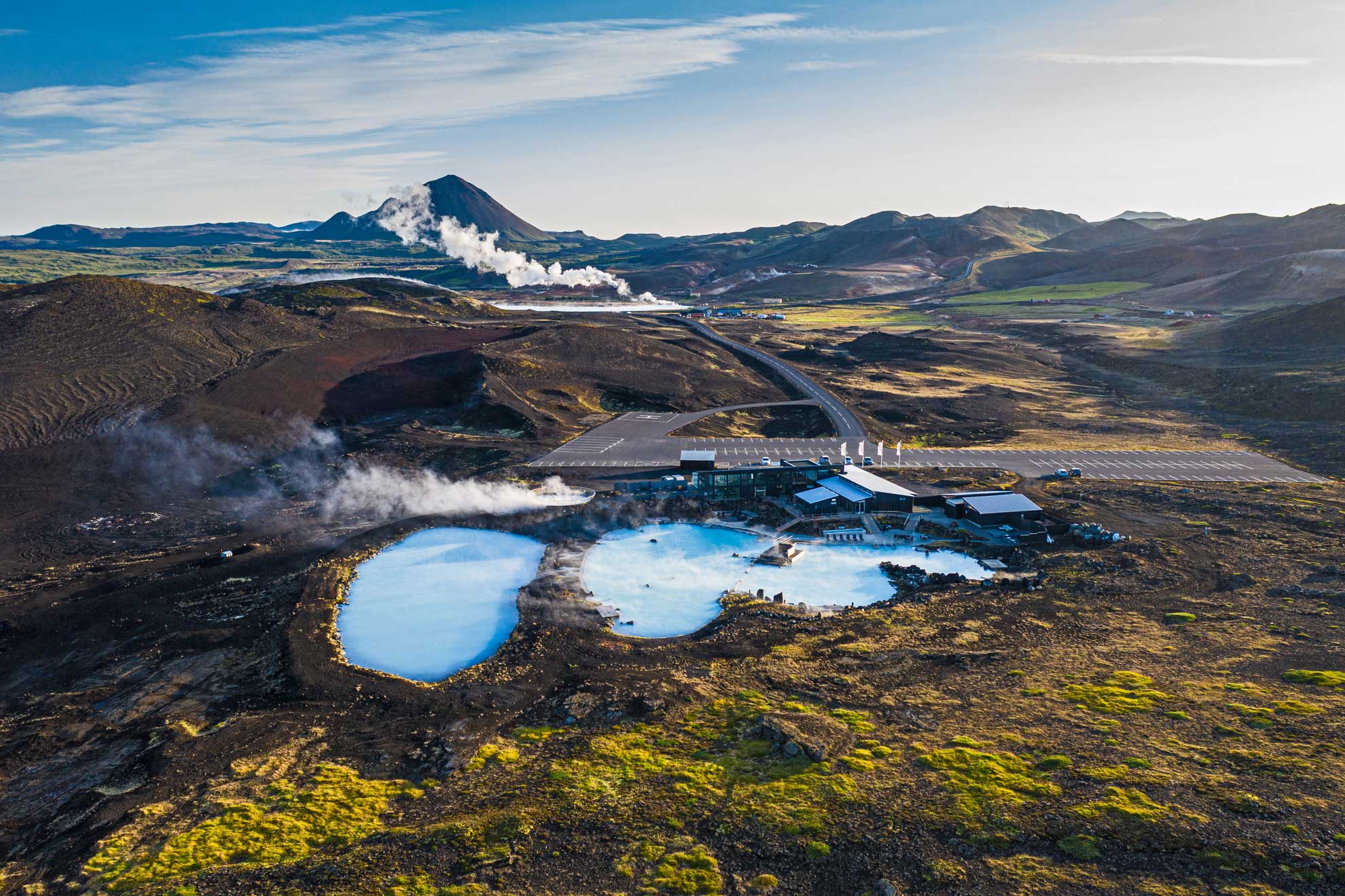
Mývatn Nature Baths have sometimes been referred to as the Blue Lagoon of northern Iceland. The warm water is rich in minerals and other energizing elements, and with its dreamy surroundings, the Nature baths are widely known for their tranquillity and beauty.
Visitors can relax in calm geothermal pools surrounded by lush green hills and looming mountain peaks, all adding to this unique Icelandic experience.
GeoSea Geothermal Sea Baths
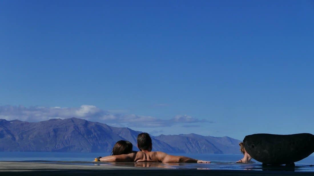
Another fantastic bathing option is the GeoSea Baths in Húsavík. With a view over mountains, Skjálfandi bay (keep an eye out for whales!) and a cute lighthouse, this is the perfect spot for relaxation and wellness.
The water at GeoSea is naturally heated seawater, filled with minerals said to relaxes the muscles and stimulates circulation.
Dog Sledding
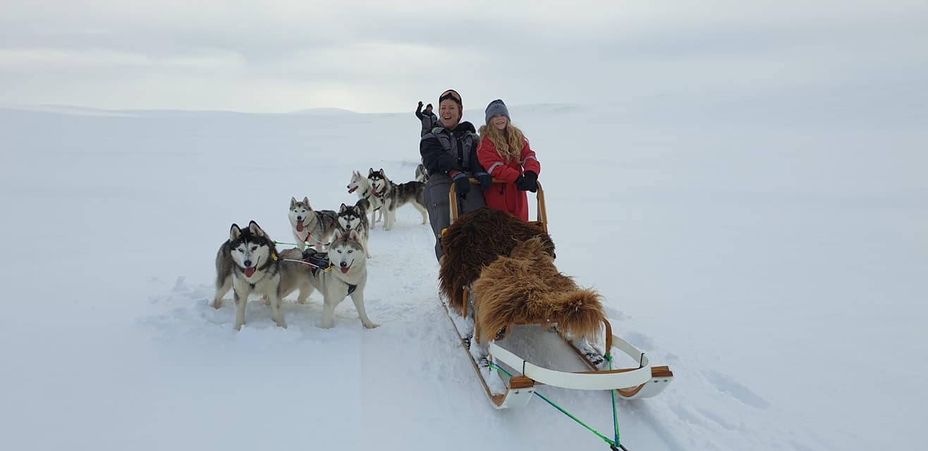
Dog sledding tours near Lake Mývatn are the perfect way to experience this beautiful winter wonderland. Imagine yourself mushing through pristine snow-capped hills and majestic ice fields in a traditional dog sledding experience.
But what if you are visiting in the summer? Don’t worry! You can explore the unique natural wonders around Lake Mývatn in a dog cart. Afterwards, make sure to give the adorable Huskies a well-deserved belly rub for their hard work.
Tips for Exploring Iceland’s Diamond Circle
Exploring Iceland’s Diamond Circle is an amazing experience. However, there are a few things to remember if you want to make the most of your trip. First, dress warmly and appropriately. North Iceland is not far from the Arctic Circle, meaning temperatures can dip into single digits even in the summertime.
Secondly, plan ahead and book any tours you may want to take in advance. For example, you don’t want to show up in Húsavík and discover that all whale-watching tours are sold out. Click here to get a free custom proposal for your perfect holiday to the Diamond Circle.
Thirdly, stay on the paths and behind the barriers, please. It’s really in everyone’s interest to preserve nature and ensure everyone survives their trip to our beautiful destinations. So stick to the allocated paths and respect the “don’t go here” signs, especially in geothermal areas with countless boiling mud pools.
Finally, take plenty of photos for memories – the views around Iceland’s Diamond Circle are unforgettable!
Best Time to Visit the Diamond Circle
The best time to visit is during the summer months, June to August, when the weather is milder. Still, winter can be just as magical if you’re up for an adventure in harsher conditions. Note, however, that the road to Dettifoss Waterfall might be closed in the winter. So make sure to check the road conditions on safetravel.is if you are travelling in the wintertime.
Summer months also provide more daylight, so you can spend longer exploring this remarkable region.
Diamond Circle Map
FAQ about the Diamond Circle
- Why is it called the Diamond Circle? Due to its shape – if you look at a map, you’ll see that its form is somewhere between a diamond and a circle. Between you and me, it doesn’t really look like a diamond. But it’s a cute story.
- How long is the Diamond Circle? About 250 kilometres, or 155 miles.
- Can I drive the Diamond Circle in one day? You can, but it’s a lot to pack into one day. I suggest you ditch the idea of a day tour and spend two or more days exploring the region.
- Is the Diamond Circle paved? Yes. The last bit of paving was finished in 2021. However, if you visit one of the Off the Beaten Path attractions suggested above, you might have to drive on a short stretch of a gravel road.
- Is it possible to drive the Diamond Circle in Winter? It is, although it is recommended that you get a 4×4 vehicle and arm yourself with plenty of patience while on the road between October and April, as North Iceland gets very cold, snowy and icy in winter. Do also consider the limited daylight hours this time of year. So consider breaking the trip into two or more parts, and be sure to check road conditions and potential road closures.
Now that you’ve learned about the various attractions and know some tips for exploring Iceland’s Diamond Circle, it’s time to start planning your trip! Click here to have an Iceland-based travel agent customize the perfect holiday to North Iceland for you!