
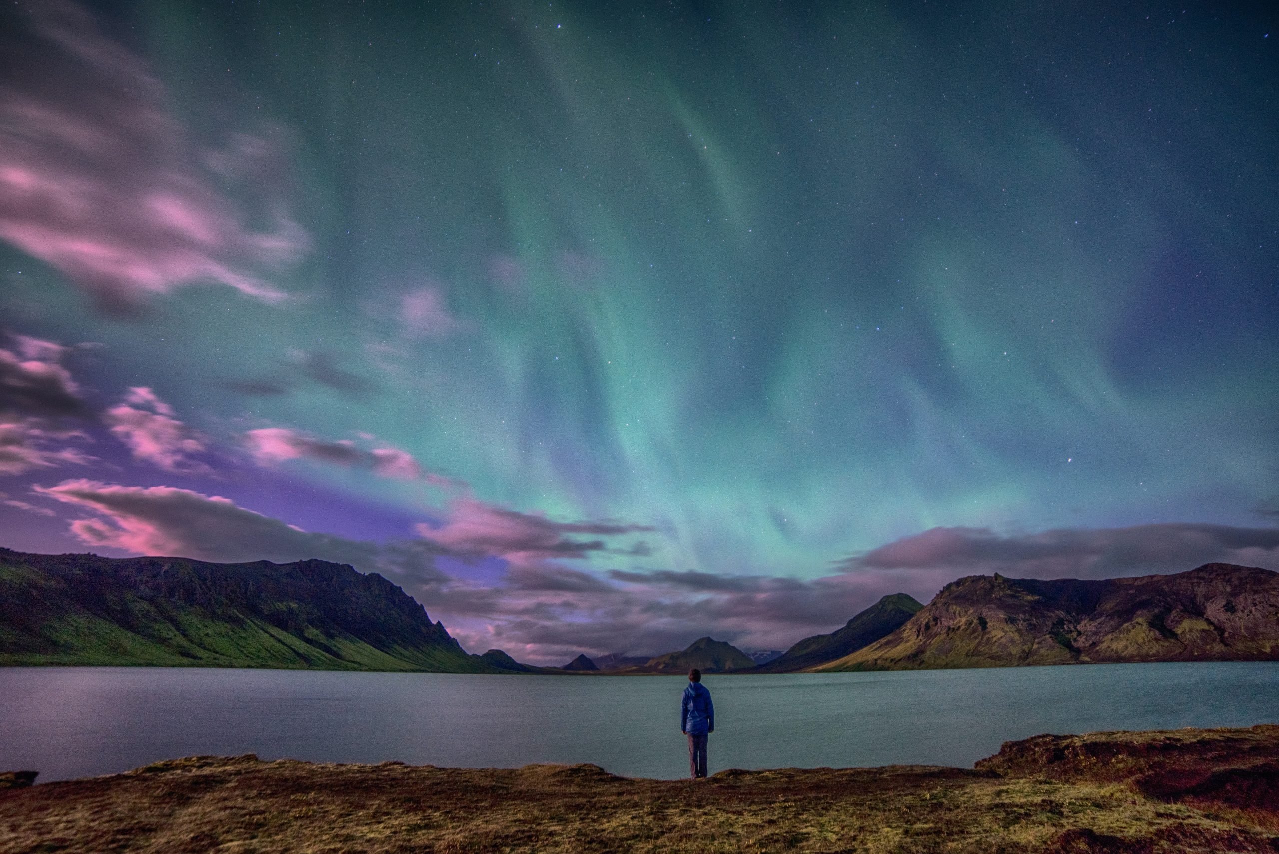
- Feature photo : Robby McCullough on Unsplash
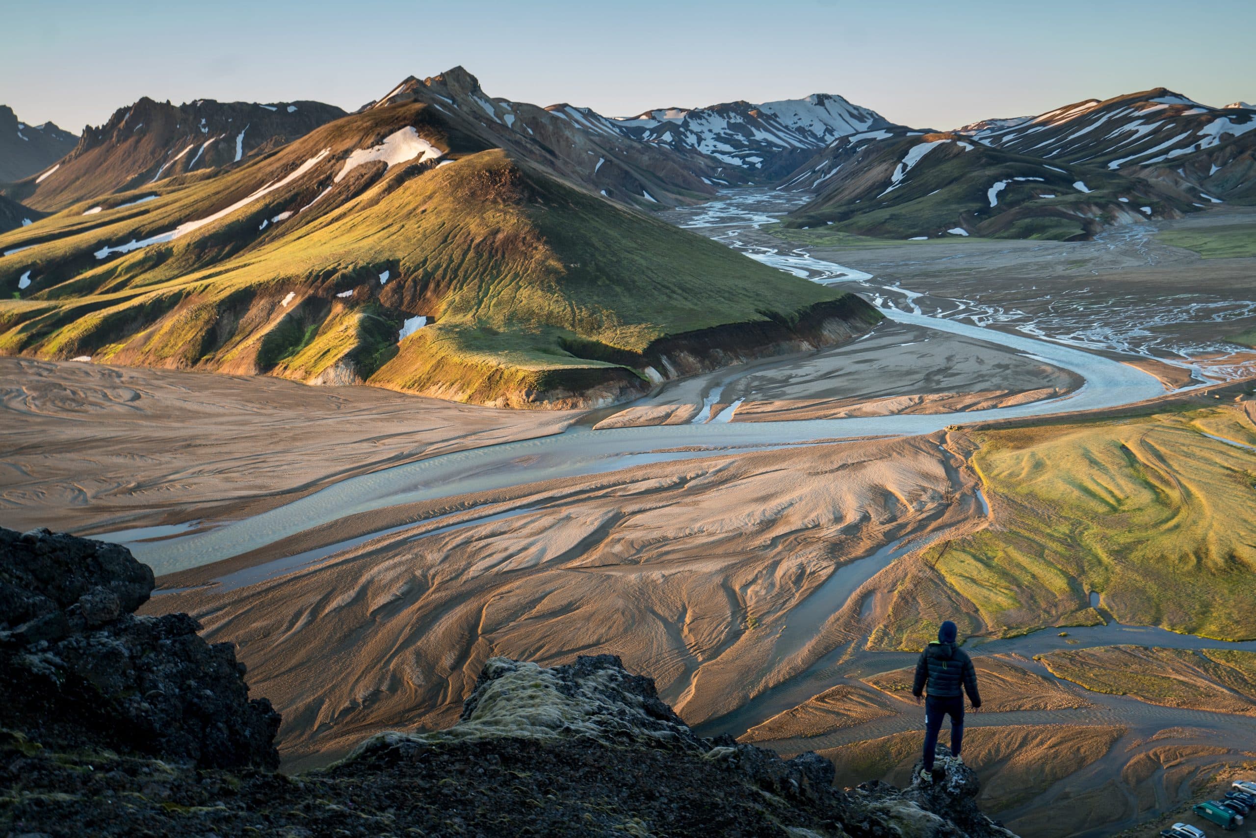
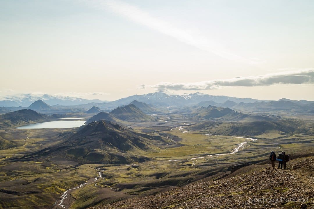
The Central Highlands of Iceland, or simply the Highlands, are a remote plateau of over 40,000 km2, considered one of the last great wilderness areas in Europe. It is home to some of the island’s most beautiful, but least visited, attractions.
Where Are the Highlands in Iceland?
Simply put, the Highlands in Iceland are located in the middle of the country. They cover around 40% of Iceland’s landmass or about 42.700 km² according to the Icelandic Institute of Natural History.
Most of the inhabited areas of Iceland are located around the island’s coastline because of warmer climate thanks to ocean winds and because the highlands are, as the name suggests, a high-altitude, mountainous region that makes human inhabitation difficult if not impossible.
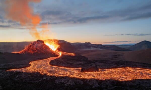
Many of the country’s volcanoes and most of Iceland’s glaciers, such as Vatnajökull, Hofsjökull, and Langjökull, are part of the Icelandic Highlands.
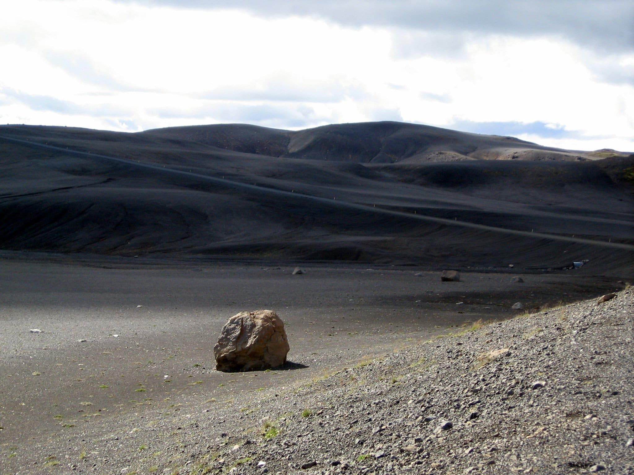
Aside from mountains, active volcanoes, and glaciers, the Highlands are also made of volcanic deserts which are unable to support any vegetation. The only flora found there is on the shores of the many glacier rivers that wind through the region.
How to Get to Iceland’s Highlands?
There are three ways one can get to the Highlands and explore this stunning region:
- Renting a 4WD vehicle and drive yourself
- Taking a Highlands bus to a designated stop on the South Coast and hike into the Highlands
- Taking a guided tour
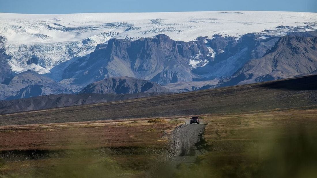
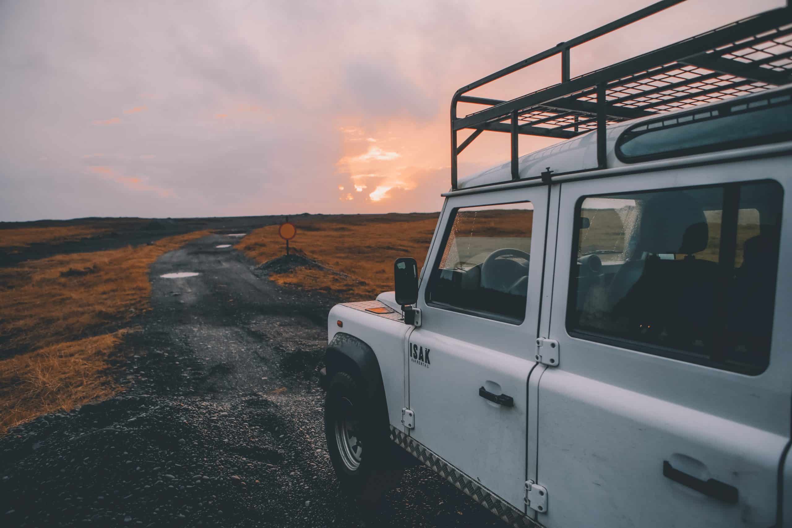
The roads to Iceland’s Highlands lead to some of this country’s most wild and beautiful natural features. However, driving these mountain roads can be a little challenging.
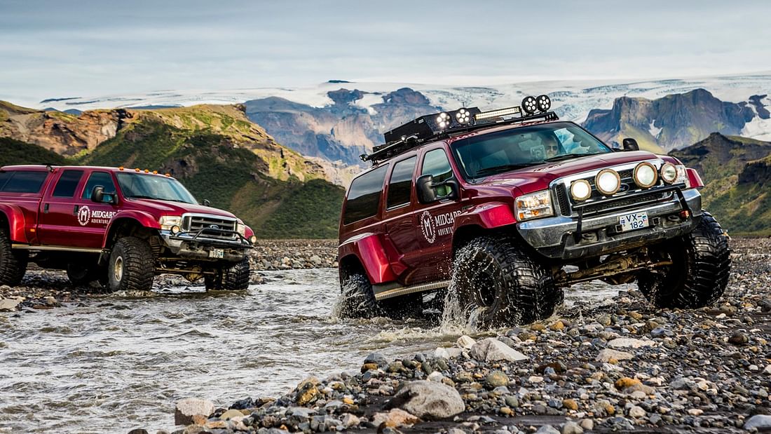
Most of the Highlands roads are so-called F-roads and are indicated with an F in front of the route number on maps, including Google Maps. The F means that these routes lead over mountainous areas, and are narrow gravel roads with no bridges over the rivers. That is why it is essential to drive a 4×4 vehicle on F-roads.
The Icelandic Road and Coastal Administration keeps the Highlands roads closed in the winter and early spring, both for drivers’ safety and to protect the environment. In the spring and summer, the sparse vegetation found in the Highlands is especially sensitive. This is why off-road driving is illegal in Iceland and can result in some hefty fines (Note: Off-road driving is illegal everywhere in Iceland, not just the Highlands).
However, visiting the Highlands in the winter is not entirely impossible. A select few tour companies have permission to drive into the Highlands on their Super Jeeps, which are customised vehicles built to handle Iceland’s rocky terrain. Their professional drivers know the land very well and they know where it is safe to drive and where not, to protect both the passengers and our fragile environment.
Highland Roads
Many roads lead to the Highlands of Iceland, but the most popular ones are Kjölur (also known as Kjalvegur), Kaldidalur, and Sprengisandur.
Kjölur – Route F35
Kjölur or Kjalvegur is the only F-road in Iceland that you can traverse without a 4×4 vehicle. However, it is not recommended you do so.
The road leads from Gullfoss Waterfall in the South to the rivers Svörtukvísl and Seyðisá in the North, not too far from the town of Blönduós. Along the way, you’ll travel between two glaciers, Langjökull in the West and Hofsjökull in the East.
Kaldidalur – Route 550
The aptly named Kaldidalur (Cold Valley) lies between the glaciers Langjökull and Okjökull. At only about 65 km (40 mi) it is the shortest of the three main Highland routes. It is also the highest mountain road in Iceland, at 727 metres (2385 ft) as it passes through Langihryggur mountain range.
Kaldidalur (also known as Kaldadalsvegur) leads to Þingvellir National Park from the western town of Húsafell. In clear weather, you’ll get a fantastic view of the glaciers Langjökull, Eiríksjökull, Okjökull, and Þórisjökull as well as the shield volcano Skjaldbreiður.
You might have noticed that there is no F in front of the route number. That is because Kaldidalur is no longer considered an F-road. However, it is still recommended that you drive a 4WD vehicle when traversing it. Furthermore, car rental agencies will not rent you a 2WD car if you plan to travel into the Highlands.
Sprengisandur – Route F26
Like most of the old Highland routes, Sprengisandsleið (or simply Sprengisandur) was used to link villages in the North to the fields of Þingvellir in the South where the Viking settlers of Iceland would hold a yearly midsummer parliament.
At 200 km (124 mi) Sprengisandsleið is the longest Highland road, reaching from Lake Þórisvatn in the South to Bárðardalur Valley near Lake Mývatn in the North. It leads between a volcanic ash desert located between the glaciers of Hofsjökull and Vatnajökull.
The name literally translates to “bursting sands”, not because of volcanic activities, but because to get across the desert, the Viking settlers needed to ride their horses as fast as possible. Seeing that this is a desert, there was no fodder for horses and no shelter either, so the only way to reach the other side was to ride the horse to the point of bursting.
How to Drive in the Icelandic Highlands?
Those planning on driving into the Icelandic Highlands themselves should consider a few things before they hit the road:
- Make sure you are driving a 4×4 vehicle capable of driving the highland roads.
- Be confident in driving on (sometimes very) gravelly roads.
- Check to see if the road you are planning to drive is open and check the road conditions at road.is.
- Register with the Icelandic Association for Search and Rescue at safe.is, in case something happens during your trip, or tell a ranger where you are planning to go.
- If possible, try to travel in two vehicles in case one gets into trouble.
- Drive slowly.
- Fill up the car! There is only one petrol station in the Icelandic Highlands (at Hveravellir).
- Be prepared for all types of weather, sun, rain, and snow, even in the summer, and know that the weather can change in a blink of an eye.
- Know that the mobile signal in the Highlands is weak. However, you can call the emergency service number, 112, even when there is no signal.
- Remember that ALL off-road driving is illegal (we love our precious nature and so we can’t stress this enough).
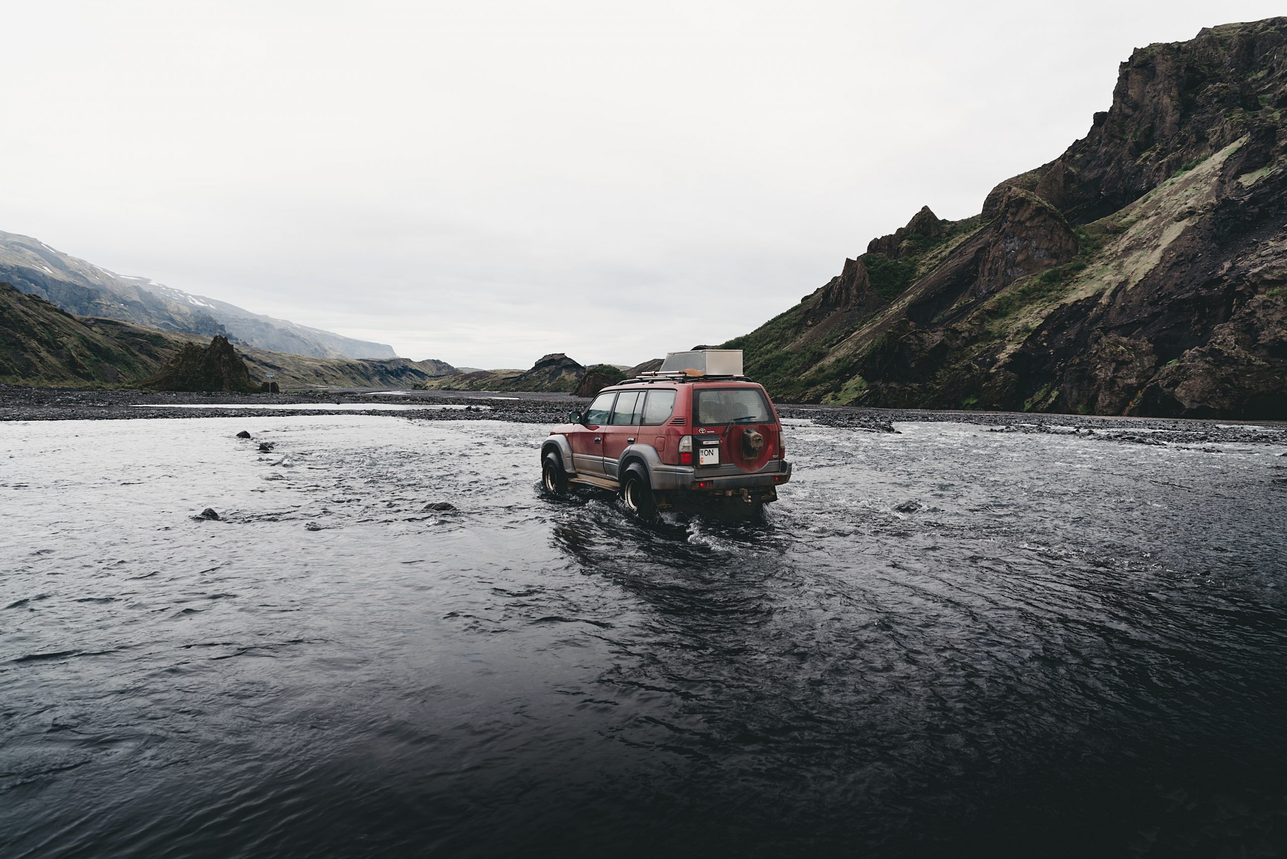
Crossing Highland Rivers in 5 Easy Steps
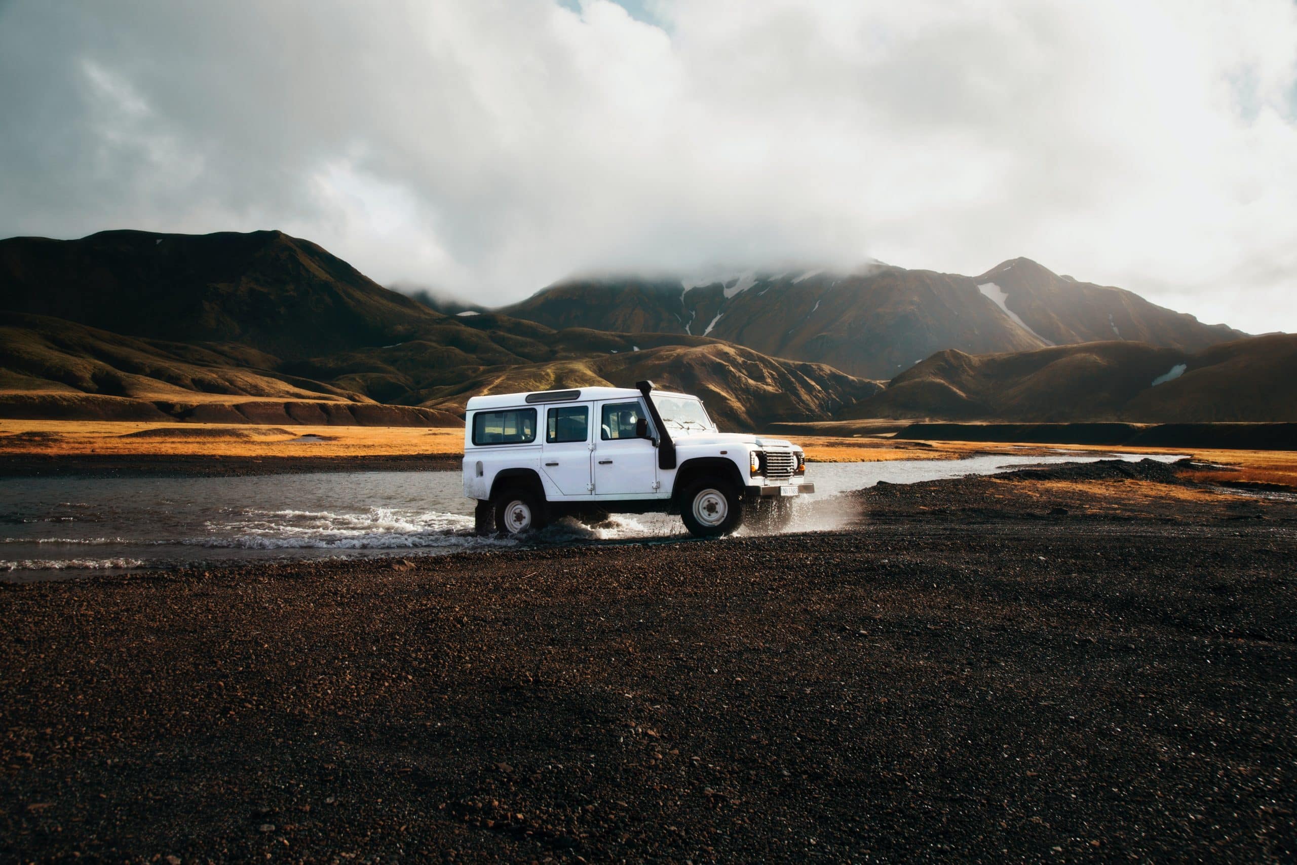
F-roads mean that there might be unabridged rivers on your path. Driving across a river requires some skill so here are a few tips to consider when crossing a glacial river in the Icelandic Highlands:
1. Travel with a partner
Cross with an experienced driver. If there is none in your group, you can wait for another traveller to come by as it is safer to cross with two vehicles.
2. Get to know the river
Glaciers feed the rivers in the Highlands, so their flow might increase on warm, sunny days as well as heavy rains. Note that although the road is open, the river is not necessarily safe for crossing. Call ahead to the nearest cabin and ask for an assessment on the river. Usually, glacial rivers have less water in the morning.
3. Assess the situation
Stop the vehicle and get out to scout the location before attempting to cross. Try to assess the depth and observe the current and the riverbed. If tracks are leading to the river, that might be the safest way to cross. However, the river can change from day to day so assess the situation yourself. The narrowest point is not the safest spot to cross. The river is usually the deepest there, so look for a wider spot. Also remember if a location seems calm, it means that it is deep.
4. Wade in
The water should not reach higher than the tires. Ensure you measure yourself against the car before you enter (it usually means the water should be about knee-high for an average adult man). While wading, you can see if there are any big boulders hidden under the current. A good rule of thumb is: if the river looks too dangerous to wade, it is too dangerous to drive across.
5. Easy does it
Engage the 4×4 drive before entering the river. Try to cross at a slight angle, with the front of the car facing downstream. Going against the current will increase the likelihood of water getting into the engine. Drive slowly! Put the car into a low gear if possible and never change gears while crossing a river. And if you get into any trouble, remember the emergency service number: 112.
The Main Icelandic Highland Attractions
Now you know how to get to the Highlands, but what should you expect to see when there? Well, don’t worry, we’ve got you covered. Below are our top 5 picks for Highland attractions. We’ve also mentioned a few extra stops you can make along the way.
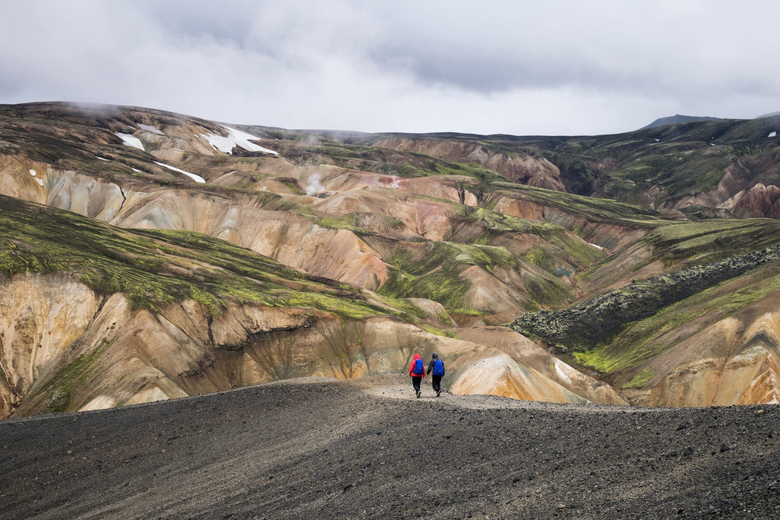
Landmannalaugar Region
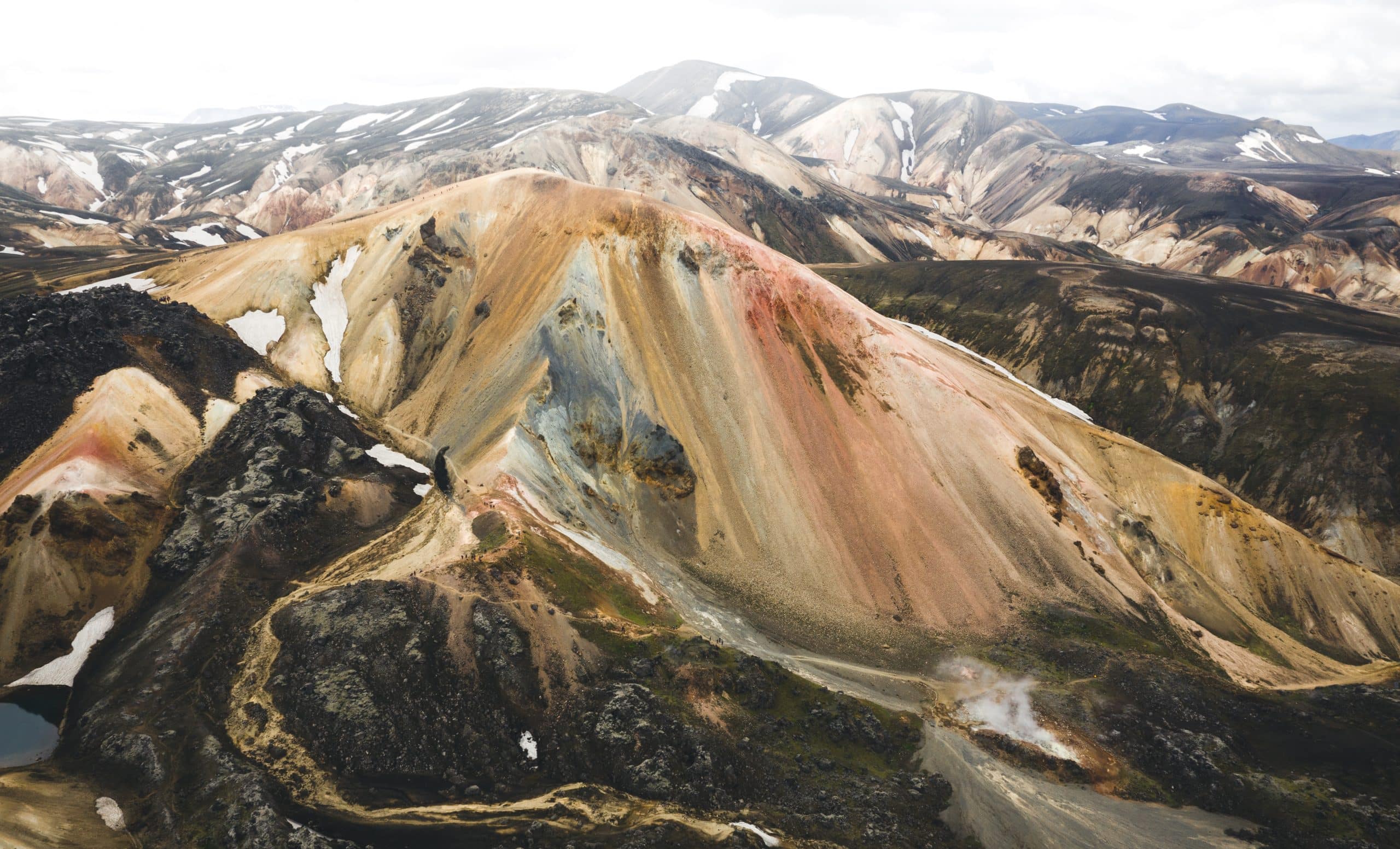
Landmannalaugar is a beautiful valley in the Fjallabak Nature Reserve in Iceland’s Highlands. It is known for its colourful mountains and geothermal hot pools.
The mountains at Landmannalaugar are made of rhyolite, a volcanic rock that appears multi-coloured when hit by the sun’s rays. On a sunny day, you can expect to see shades of red, pink, golden yellow, green and blue.
Here, you can also take a dip in the natural geothermal hot springs and unwind after a day on the Highlands’ rocky roads.
The name of the region means “The People’s Pools” and was used as a retreat for weary travellers in Centuries gone by. In a way, it still is a retreat. However, Landmannalaugar is now more the destination rather than the stop along the way.
Þórsmörk Valley
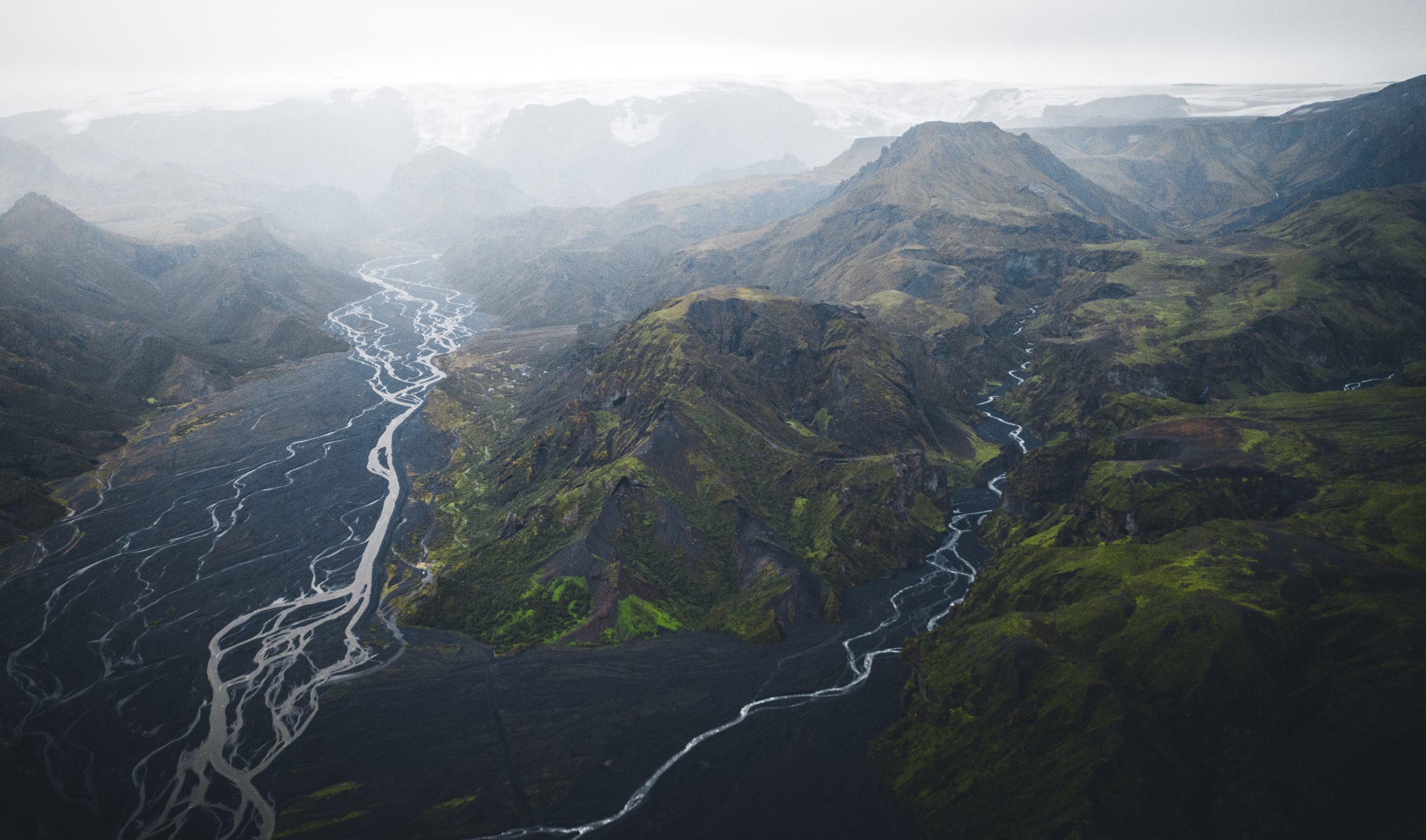
The stunning Þórsmörk Valley is located in the southern parts of the Highlands. It is closed off by the glaciers Tindfjallajökull, Eyjafjallajökull, and Mýrdalsjökull, and the river Krossá, creating a small and secluded haven for those lucky enough to visit.
Due to the valley’s location, the climate is much warmer and calmer than in the rest of South Iceland and Highlands. Here, plant life of moss, birchwood, fern and other small shrubs are found in abundance. The glaciers and the river also protect vegetation from free-roaming sheep.
Þórsmörk is a popular location amongst hikers with a multitude of hiking paths and treks available.
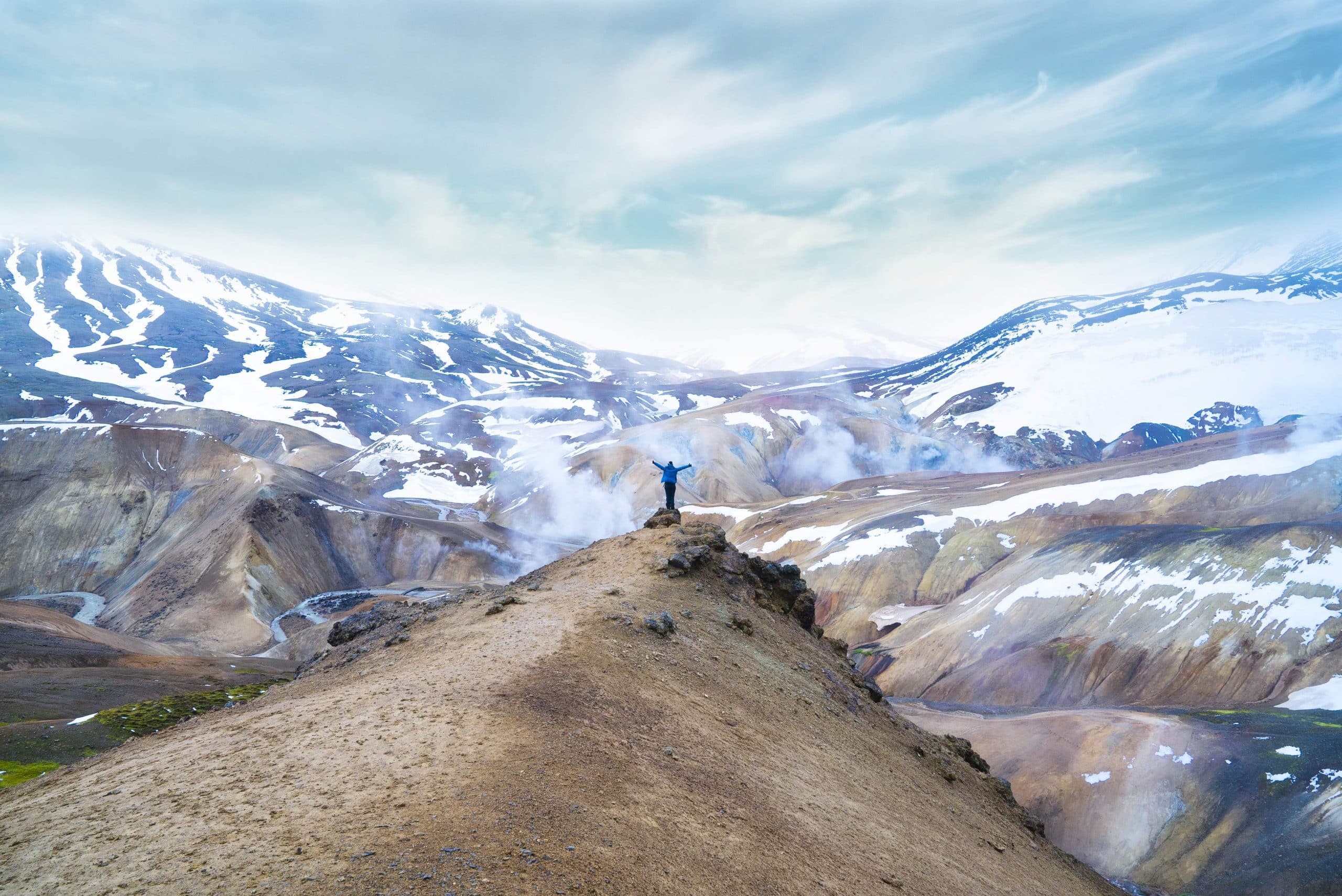
Kerlingarfjöll Mountain & Hveradalir Geothermal Area
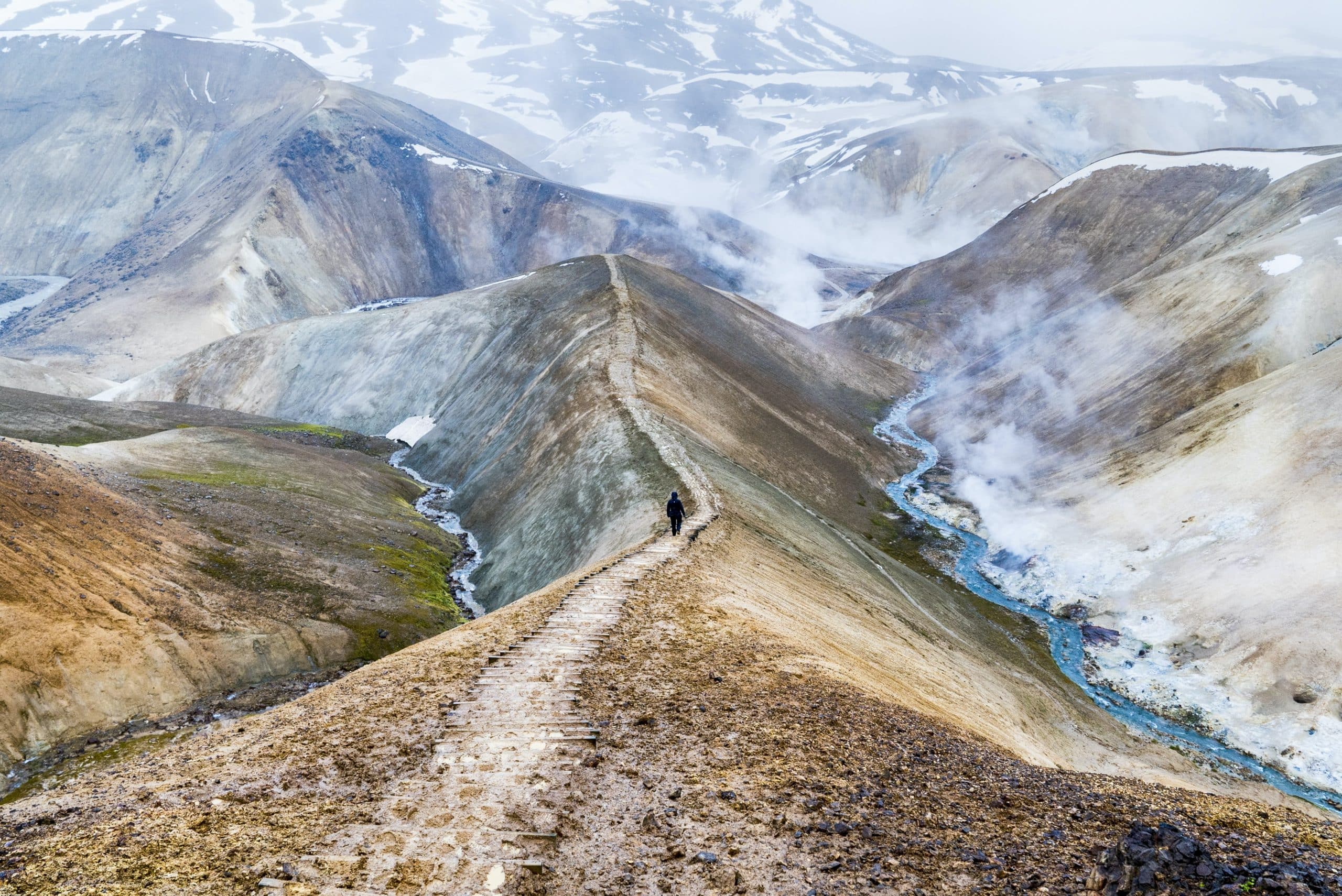
Near the Kjölur Road, you can find the 1,477 metre (4,846 ft) tall mountain range of Kerlingarfjöll, one of the most picturesque areas of Iceland.
Here, the rhyolite rock in the mountain provides the region it’s colourful appearance, and the geothermal activity adds an otherworldliness facade with bubbling mud pools, hot springs, and white plumes of steam.
Located in the area is the geothermal valley of Hveradalir. The hike from the Kerlingarfjöll Mountain Resort to Hveradalir is around 5 km (3 mi) and the roundtrip will take you about two and a half hours. However, you might want to add a couple of hours to this time if you want to fully explore this otherworldly area.
Askja Caldera & Víti Crater
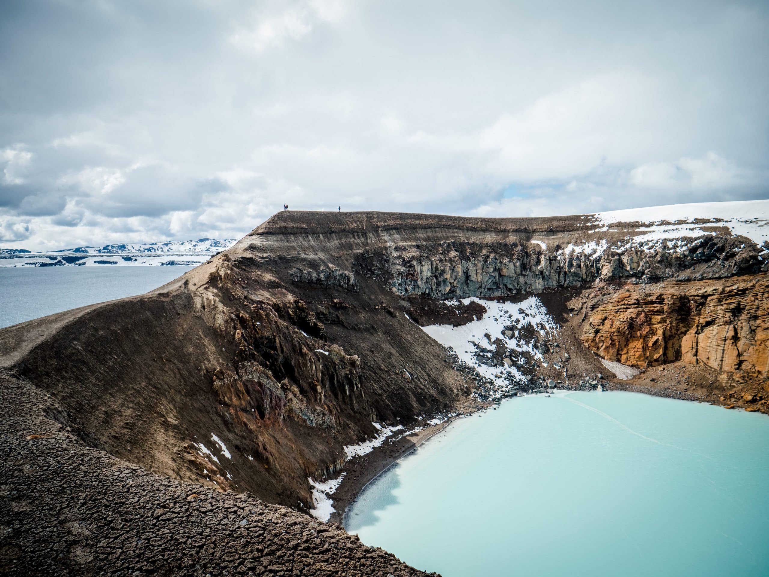
Around 15 km (9 mi) North of Vatnajökull glacier is the Dyngjufjöll Mountain Range which surrounds the volcano Askja.
The name, Askja, also refers to a series of calderas which are essentially sunken craters located in the volcano. Over time, these empty craters have filled with water and now form Iceland’s second-deepest lake, Öskjuvatn (translation: Askja’s Lake).
On the northern shores of Öskjuvatn is the biggest crater in the area, Víti. Although the name translates to ‘Hell’ in English, the crater is actually quite beautiful. It is filled with opaque, mineral-rich, blue water which stays generally at around 30°C (86 °F). It is a great place for bathing but remember that the pathway to the crater can be slippery and the surrounding mud very hot.
The area around Askja is nothing but a barren wilderness, reminiscent of a lunar landscape. Which is perhaps why groups of Apollo astronauts travelled there in the 1960s to prepare for their mission to the moon.
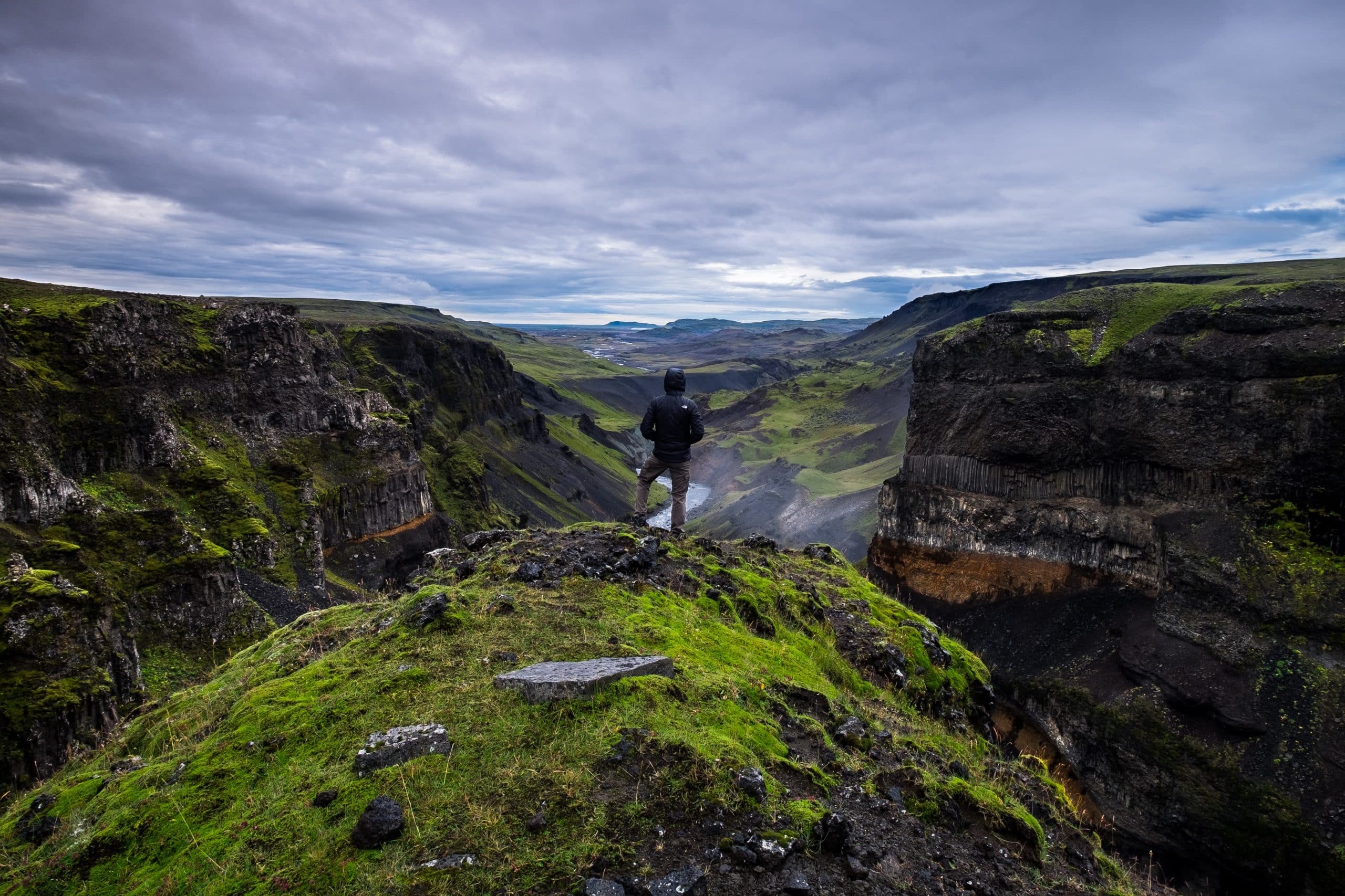
Aldeyjarfoss Waterfall
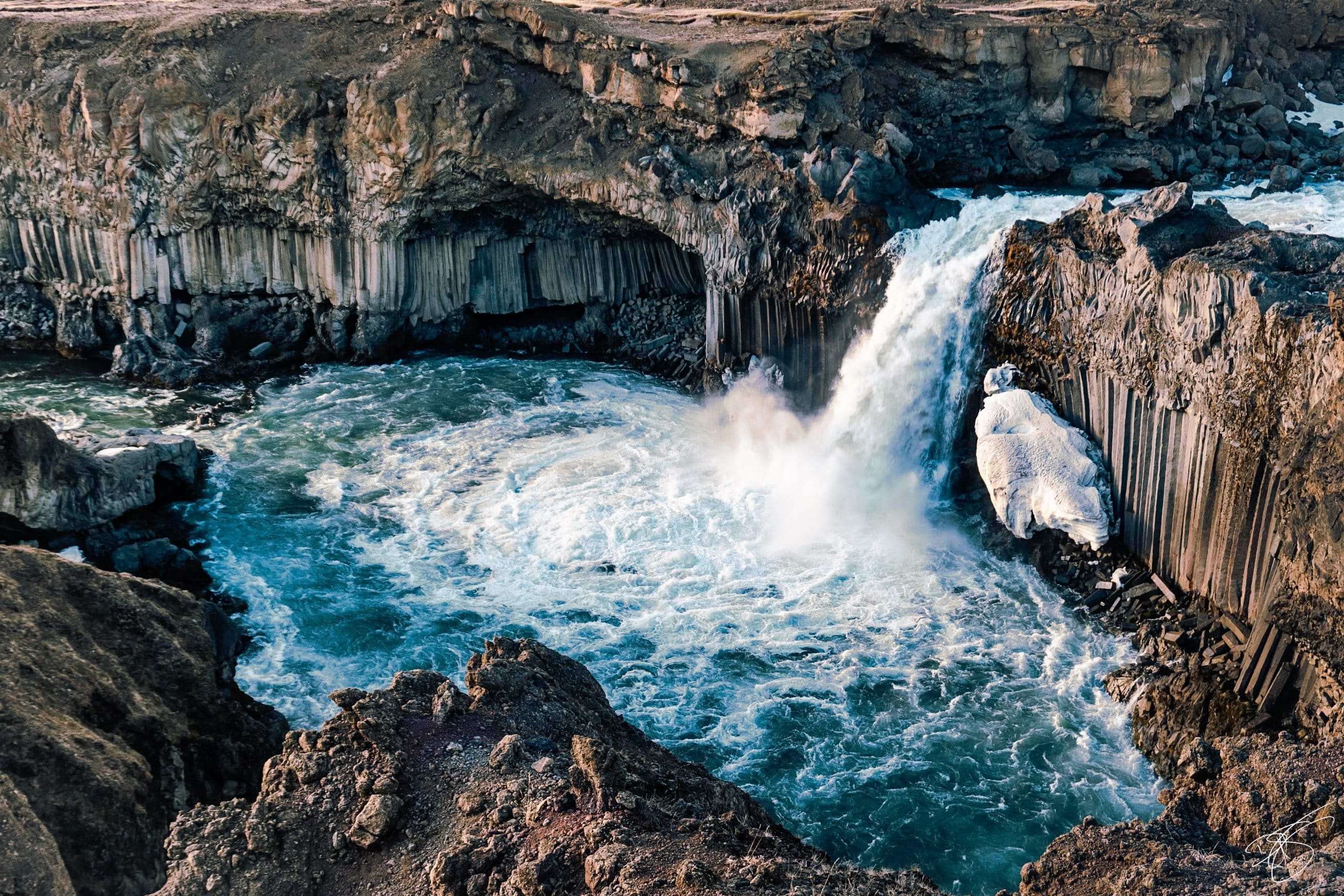
Aldeyjarfoss is one of the most beautiful waterfalls in Iceland, buried deep in the almost impassable Highlands, making it a genuine hidden gem.
The waterfall is located in the glacial river Skjálfandafljót in the northern part of the Highlands. The icy cold water forces its way from Báðardalshraun lava field, created in an eruption some 9,000 years ago, before dropping 20 metres into a basin below.
Surrounding the pool basin are stunning cliffs made of basalt columns, a type of rock formed from the rapid cooling of lava. Similar types of columns can be found on Reynisfjara Beach and by Svartifoss Waterfall, both found on Iceland’s south coast.
About 3 km drive from Aldeyjarfoss on F-26 is another, vastly different but equally beautiful waterfall, Hrafnabjargafoss. This one falls in two streams on either side of a big rock into a bowl-shape gorge.
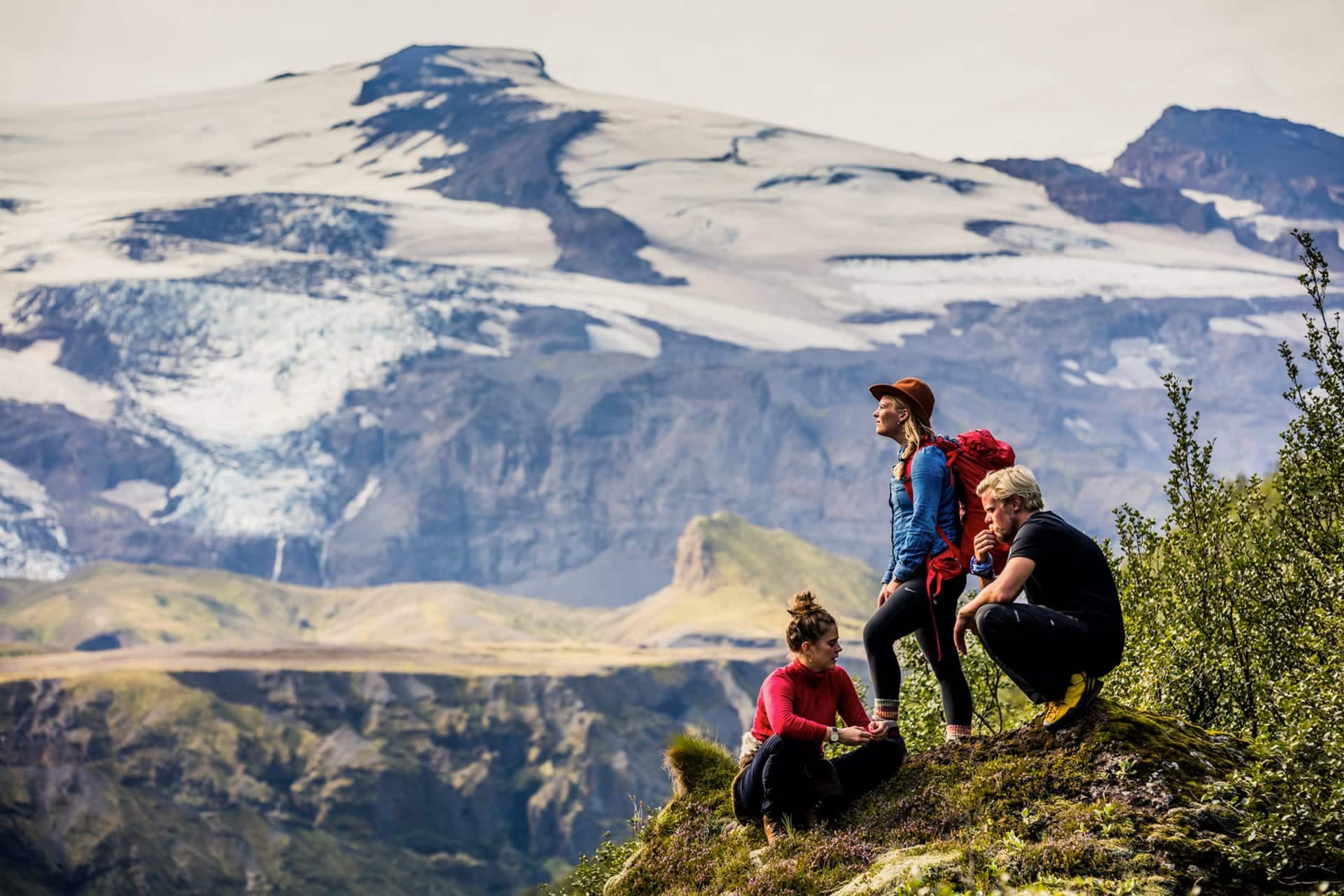
Best Hikes in Iceland’s Highlands
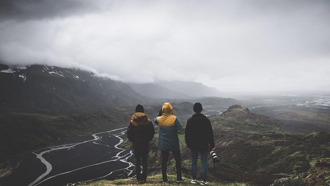
Without a doubt, one of the best things you can do in the Highlands is hiking. There are countless hiking trails and tracks leading through lava fields, between glaciers, past waterfalls, or across rivers. Along the way, you can expect stunning views unlike anywhere else.
To get to most of the attractions mentioned above, you’ll need to hike, and most of them — such as Þórmsörk Valley — offer a multitude of hiking options which can last from just a few minutes to many hours.
Below, however, is a list of multi-day hikes which are perfect for the outdoorsy nature lover who is looking to fully immerse themselves in the wilderness of Iceland.
Laugavegur Hiking Trail
Not to be confused with the Laugavegur Shopping Street in Reykjavík city, Laugavegur Hiking Trail runs from the hot springs area of Landmannalaugar to the beautiful Þórsmörk Valley.
Completing the hike takes between two to four days. This includes stops at mountain huts, campsites, and geothermal pools. Along the way, you’ll see canyons, rivers, and glaciers before arriving in a lush, green oasis named Þórsmörk Valley.
The trek is about 55 km (34 miles) and is noted for its diverse and spectacular landscapes. While hiking, you’ll have to cross lava fields and at least three rivers.
Avid hiking enthusiasts can combine the trek with a hike over Fimmvörðuháls Pass, which leads from Þórsmörk to the Skógar Area in South Iceland.
Fimmvörðuháls Hiking Route
The 22 km (14 mi) hike between Þórmsörk Valley and the Skógar Region in South Iceland is one of the most popular hiking treks in Iceland. It will lead you between two glaciers, Eyjafjallajökull and Mýrdalsjökull.
En route, you’ll see Goðahraun, a new lava field created in the 2010 eruption of Fimmvörðuháls Volcano. Nearby are two craters named Magni and Móði, after the sons of Thor, the Norse god of thunder and lightning.
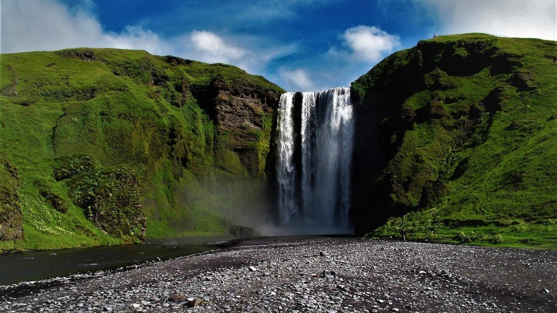
The trek has a 1,000-metre climb up and above the majestic Skógafoss Waterfall on Iceland’s south coast. You’ll also travel along the Skógá River and get amazing views of mountains and volcanoes.
Hiking Fimmvörðuháls takes around 8-12 hours at a brisk walking pace. Like everywhere in the Highlands, the weather can be fickle, so make sure you check the weather forecast before embarking on the journey and while you are hiking.
Other Options:
The Laugavegur Hiking Trail and Fimmvörðuháls Route are, by far, the most popular hiking routes in the Icelandic Highlands. However, they are far from being the only ones. Below are a few lesser-known routes that are equally as interesting and spectacular.
Mt. Sveinstindur to the Eldgjá Volcanic Fissure
This route will show you the massive Vatnajökull Glacier, the beautiful Lake Langisjór, and the moss-covered lava fields of the Lake Craters. You’ll follow along the shores of the Skaftá River, up Uxatindar Peaks until you reach Eldgjá Canyon. The hike is around 42 km (26 mi) and takes around 4 days with overnight stays in mountain huts.
The Torfajökull Rhyolite Massif
Another long but scenic hike is in Fjallabak Nature Reserve. Here, you’ll find Iceland’s largest rhyolite area and the third biggest geothermal region. The trek will lead you across jet-black sands to lakes, rivers, and mountains. En route, you can unwind in a natural pool between the glaciers Torfajökull and Mýrdalsjökull. The trek is quite challenging, as it is 58 km (36 mi) long and usually takes around 5 days with overnight stays in mountain huts.
Álftavatn Lake, Emstrur Area, & Þórsmörk
A relatively easy hike (that still takes two days) is the 30 km (18 mi) hike from Lake Álftavatn to Þórsmörk via the desolate region of Emstrur. The scenic hike will lead you to ravines, rivers, and canyons. Two mountain huts are on the way, the first one is over 50 years old, originally made for sheep herders in the region, the second one for other travellers.
How Long Should You Spend in the Icelandic Highlands?
How long to spend in the Icelandic Highlands depends on what you are planning on doing there. You can spend just a few hours there or a few days.
Those only looking for a small taste of the highlands can spend an entire day there, perhaps driving the Kaldidalur or the Kjölur Route with a few detours. Single-day tours are also available where you explore the region with a guide in just a few hours. Travelling with a guide or somebody who knows the area will allow you to see more in a shorter amount of time.
Of course, you can always explore the area in-depth by spending the night at a campsite in the region (there are not many hotels or other accommodations there). Hikers in the Highland can also expect to spend 2-4 days in the area during their trip.
What to wear in the Highlands?
The weather in the Icelandic Highlands can be very unpredictable. You might set out on a hike when the weather is sunny but it can quickly change so make sure you are prepared for anything.
The essentials to bring to the Icelandic Highlands are:
- Good hiking shoes
- Wind and waterproof outer clothes
- Warm jumper (wear layers, that way you can easily remove something if it gets too hot)
- T-shirt
- Sunglasses
- Sunblock
- Water bottle
- Snacks
Camping in Iceland’s Highlands
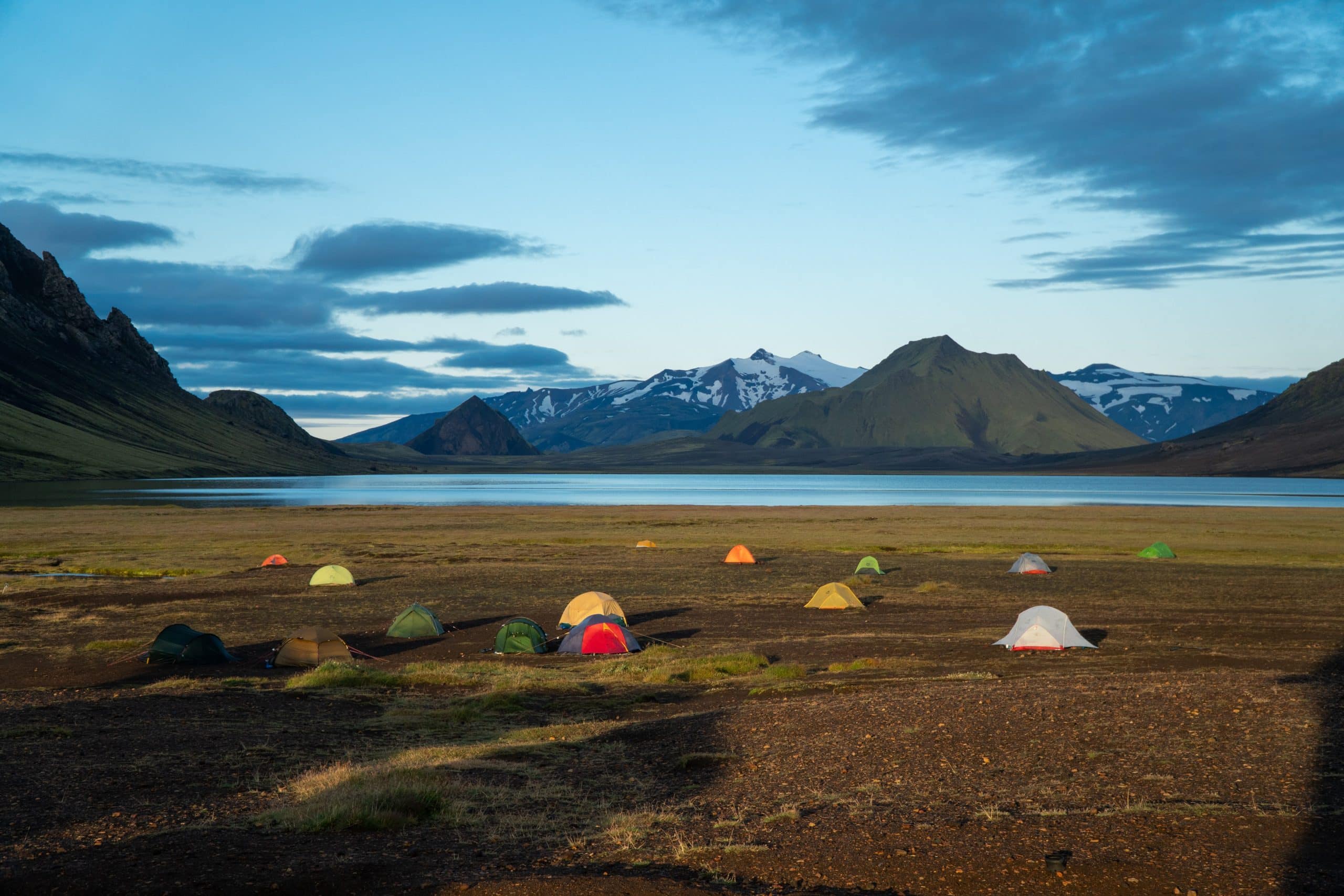
There are 11 campsites in the Icelandic Highlands. All of them have adequate facilities with toilets and electricity. Many are situated near geothermal pools so you can have a relaxing dip after a day of hiking and sightseeing.
- Básar Camping Site in Þórsmörk (Básar Area)
- Volcano Huts Camping Site in Þórsmörk (Húsadalur Valley)
- Skagafjörðsskáli Camping Site in Þórsmörk (Langidalur Valley)
- Botnar Camping Site in Þórsmörk (Emstrur Area)
- Landmannalaugar Camping Site
- Strútur Hut & Camping Site in Landmannalaugar
- Hrafntinnusker Hut & Camping Site in Landmannalaugar (Hrafntinnusker Area)
- Álftavatn Camping Site in Landmannalaugar (near Álftavatn Lake)
- Landmannahellir Camping Area
- Camping Site at Mountain Hut Sveinstindur near Lake Langisjór
- Veiðivötn Camping Site near Veiðivötn Lakes
On hiking trails are mountain huts in which you can stay. However, you need to reserve them beforehand.
Summary
Those looking to get off the beaten path and away from the crowds in Iceland can do no better than the beautiful Highland Region. This uninhabited region is located in the centre of Iceland. It is characterised by the barren beauty of lava fields, volcanoes, and glaciers.
Getting there requires you to either rent a 4×4 car, take a bus or a guided tour. The guided tour is the most convenient way as driving the Highland roads can be a little tricky, seeing that you might need to cross rivers in your car. Furthermore, you’ll get the wisdom and insight of a trained, local guide.
There are countless gorgeous sites to visit in the Highlands. The most popular ones are Landmannalaugar Geothermal Region and Þórsmörk Valley. Other notable attractions are the Askja Caldera and Víti Crater, Aldeyjarfoss Waterfall, and Kerlingarfjöll Mountains.
Hiking is a favourite activity for many who visit. The most famous trails are the Laugavegur Trek and the Fimmvörðuháls Hiking Route. Hiking in the highlands can take between a few hours and a few days, depending on the route.
There are only a handful of accommodations in the Icelandic Highlands, and most people prefer to stay at camping sites, of which there are 11. There are also mountain huts which you need to book in advance.
Traveo will be happy to help you create your perfect trip to the Icelandic Highlands. Just tell us what you want to see and do, and we’ll take care of the rest.